- Usage in publication:
-
- Margeson Creek gneiss*
- Modifications:
-
- Named
- Dominant lithology:
-
- Gneiss
- AAPG geologic province:
-
- Lake Superior region
Summary:
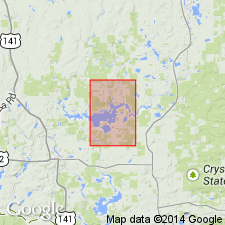
Is formation of gneissic and granitic rocks named "after Margeson Creek along which are many exposures in sec. 12, T.44 N., R. 32 W., [Kelso Junction quadrangle]; secs. 6 and 7, T. 44 N., R. 31 W., [Kiernan quadrangle]; and sec. 31, T. 45 N., R. 31 W., [Hickman Lake quadrangle]" Iron Co, MI (Lake Superior region). Type locality not designated. Mapped at core of Amasa oval in northwest part of Kiernan quad. Mainly granitic rocks generally foliated and gneissic. Granitic rocks typically pink to gray, medium to coarse grained, equigranular or inequigranular, commonly with large tabular, more or less well-aligned crystals of microcline and albite; range from granite to tonalite with quartz monzonite and granodiorite predominating. Two narrow zones of mylonitized granitic rock present southern end of outcrop area; includes considerable gray to gray-green banded gneiss, generally forming only small parts of outcrops that are largely granitic rocks; bands of gneiss from less than 1 in to about 1 ft thick, well defined and persistent to poorly defined, lensoid, and of limited extent. Gneissic granitic rock grades into nonfoliated and pegmatitic phases in places; gneiss mainly granodioritic to tonalitic with biotite-rich seams. Amphibolite and micaceous schists minor members; locally small amounts of migmatite present between banded gneiss and granitic rocks. Unconformable contact with overlying Randville dolomite. Agrees with "Archean" age of previous workers, but term "Archean" not used; assigned to "Lower Precambrian."
Source: GNU records (USGS DDS-6; Reston GNULEX).
For more information, please contact Nancy Stamm, Geologic Names Committee Secretary.
Asterisk (*) indicates published by U.S. Geological Survey authors.
"No current usage" (†) implies that a name has been abandoned or has fallen into disuse. Former usage and, if known, replacement name given in parentheses ( ).
Slash (/) indicates name conflicts with nomenclatural guidelines (CSN, 1933; ACSN, 1961, 1970; NACSN, 1983, 2005, 2021). May be explained within brackets ([ ]).

