

- Usage in publication:
-
- Magenta member*
- Modifications:
-
- Revised
- Overview
- AAPG geologic province:
-
- Permian basin
Summary:
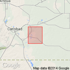
Is one of five divisions of Rustler formation described. Contacts of Magenta revised. Overlies the newly named Tamarisk member of the Rustler formation and underlies the newly named Forty-niner member of the Rustler. Mapped (geologic map) in west and central part of quad., Eddy Co., NM in the Permian basin. Description of drillhole cuttings. Stratigraphic chart. Is characterized by alternating laminae of red to pink dolomite and yellow-green anhydrite (or gypsum) in wavy or lenticular laminae 0.2 to 5 mm thick. The dolomite is more resistant to erosion than the dolomite, and stands out in high relief. Is about 20 ft thick. Of Late Permian age.
Source: GNU records (USGS DDS-6; Denver GNULEX).
For more information, please contact Nancy Stamm, Geologic Names Committee Secretary.
Asterisk (*) indicates published by U.S. Geological Survey authors.
"No current usage" (†) implies that a name has been abandoned or has fallen into disuse. Former usage and, if known, replacement name given in parentheses ( ).
Slash (/) indicates name conflicts with nomenclatural guidelines (CSN, 1933; ACSN, 1961, 1970; NACSN, 1983, 2005, 2021). May be explained within brackets ([ ]).