

- Usage in publication:
-
- Lovell Wash Member*
- Modifications:
-
- Named
- Geochronologic dating
- Dominant lithology:
-
- Limestone
- Dolomite
- Claystone
- Tuff
- Sandstone
- AAPG geologic province:
-
- Great Basin province
Summary:
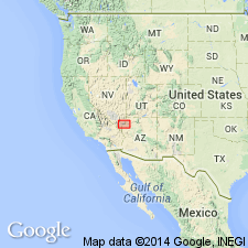
Named as the upper member (of 4) of Horse Spring Formation for exposures in Lovell Wash, Clark Co, NV in the Great Basin province. Type section is in the wash at lat 36 deg 12' 45" N and long 114 deg 42' 32" W, Hoover Dam quad. Is about 250 m thick at type; ranges from 170 m thick between Lava Butte and Gypsum Wash (west) to 450 m thick at White Basin (east), all localities in Clark Co. Present in scattered exposures from Lava Butte on west to Bitter Ridge on east, and north of Lake Mead. Distribution map. Stratigraphic columns. Overlies newly named Bitter Ridge Limestone Member of Horse Spring. Underlies, unconformably at some localities, the unnamed red sandstone unit. Consists chiefly of white limestone and dolomite, gray and white claystone, gray and brown tuff and tuffaceous sandstone, and arenaceous tuff. Brown chert at many localities as pods, lenses, thin beds, mounds, etc. Most of the tuff is reworked. Tuff beds derived from regional ash-falls vary from a m to tens of m thick. Limestone has teepee structures, stromatolitic beds. Local sandstones, siltstones, conglomerates derived from southern source. A lacustrine deposit. Estimated as 13.0 to 11.9 m.y. old, or Miocene. A tuff near type dated (Z-Ft) at 13.0 +/-0.8 m.y.
Source: GNU records (USGS DDS-6; Denver GNULEX).
For more information, please contact Nancy Stamm, Geologic Names Committee Secretary.
Asterisk (*) indicates published by U.S. Geological Survey authors.
"No current usage" (†) implies that a name has been abandoned or has fallen into disuse. Former usage and, if known, replacement name given in parentheses ( ).
Slash (/) indicates name conflicts with nomenclatural guidelines (CSN, 1933; ACSN, 1961, 1970; NACSN, 1983, 2005, 2021). May be explained within brackets ([ ]).