

- Usage in publication:
-
- Little Tanks Basalt*
- Modifications:
-
- Named
- Mapped
- Geochronologic dating
- Dominant lithology:
-
- Basalt
- AAPG geologic province:
-
- Plateau sedimentary province
Summary:
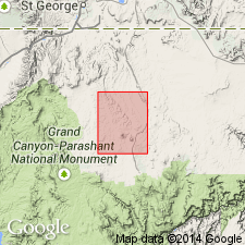
Named for exposures located just east and southeast of Little Tanks reservoir (a large stock pond), the designated type area, located in sec 5, T36N, R10W, northern Mohave Co, northwestern AZ, Plateau sedimentary province. Occurs in south-central part of map area (USGS Little Tanks 7.5' quad). Consists of basalt flows, associated dikes, and pyroclastic deposits, each separately mapped. Flows are dark-gray, finely crystalline basalt; aphanitic groundmass of plagioclase, olivine, and augite. Flows are up to 6 m thick and occur on Harrisburg Member of Kaibab Formation, lower red member and Virgin Limestone Member of Moenkopi Formation, and older alluvial-fan deposits. Intrusive dike or vent area consists of dark-gray, finely crystalline aphanitic basalt; black augite and green olivine crystals. Cinder and pyroclastic deposits are unconsolidated and consist of red-brown and black fragments of angular basaltic scoria; dark-gray augite and olivine glass fragments; associated with vent and dike extrusions; forms cinder cone as much as 40 m thick. Older than younger Pleistocene and Holocene surficial deposits; younger than newly named Moriah Knoll Basalt (Pleistocene). Assigned Pleistocene age based on K-Ar whole-rock age of 1.0 +/-0.4 Ma (Harold Mehnert, 1993, USGS, written commun.).
Source: GNU records (USGS DDS-6; Denver GNULEX).
For more information, please contact Nancy Stamm, Geologic Names Committee Secretary.
Asterisk (*) indicates published by U.S. Geological Survey authors.
"No current usage" (†) implies that a name has been abandoned or has fallen into disuse. Former usage and, if known, replacement name given in parentheses ( ).
Slash (/) indicates name conflicts with nomenclatural guidelines (CSN, 1933; ACSN, 1961, 1970; NACSN, 1983, 2005, 2021). May be explained within brackets ([ ]).