

- Usage in publication:
-
- Little Creek formation*
- Modifications:
-
- Original reference
- Dominant lithology:
-
- Tuff
- Basalt
- AAPG geologic province:
-
- Snake River basin
Summary:
Pg. G8 (fig. 2), G19-G21, pl. 1. Little Creek formation. Massacre volcanics of Stearns and others (1938) and Stearns and Isotoff (1956) includes at least two groups of volcanic groups separated by an unconformity. Older and more widespread of these groups is here distinguished from Massacre volcanics and named Little Creek formation. (According to interpretation used herein Massacre volcanics do not occur in American Falls quadrangle, this report.) Formation consists of: (1) upper basalt member, a single flow of dark-gray dense to locally porous fine-grained basalt with little visible olivine, normally 5 to 25 feet thick; and (2) lower tuff member, yellowish-tan to reddish-brown basaltic tuffaceous sandstone, and dark-gray to tan lapilli tuff and tuff-breccia, 10 to 75 feet thick. Thickness of formation generally 20 to 50 feet. Unconformably overlies Walcott tuff; unconformably underlies Raft formation. Age is considered Pleistocene(?).
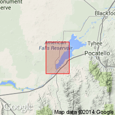
Type locality in American Falls 15-min quadrangle, Power Co., southern ID: (1) tuff member in N/2 sec. 6, T. 8 S., R. 31 E., and SW/4 sec. 31, T. 7 S., R. 31 E., near mouth of Ferry Hollow and in south bluff of Snake River [approx. Lat. 42 deg. 45 min. 44 sec. N., Long. 112 deg. 52 min. 54 sec. W.]; and (2) basalt member, at American Falls [in vicinity of Lat. 42 deg. 47 min. 06 sec. N., Long. 112 deg. 51 min. 42 sec. W.]. Named from exposures along Little Creek, in T. 10 S., R. 31 and 32 E., Rockland 15-min quadrangle, Power Co., southern ID.
Source: Publication; US geologic names lexicon (USGS Bull. 1350, p. 428-429).
- Usage in publication:
-
- Little Creek Formation*
- Modifications:
-
- Revised
- Age modified
- Redescribed
- Overview
- AAPG geologic province:
-
- Snake River basin
Summary:
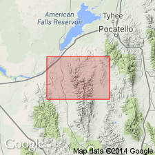
Revised in that a thin basalt flow that underlies much of northern part of Rockland quad north of Rocky Hollow, east of Rock Creek that was formerly assigned to Little Creek is here reassigned to Massacre Volcanics. This basalt flow overlies Little Creek with an angular unconformity and is petrographically similar to basalts of Massacre. Little Creek as revised consists of tuff and tuff breccia and in study area only occurs in northern part of Rockland quad in Power Co, ID, Snake River basin. Little Creek varies greatly in thickness ranging up to 75 ft near viewpoint along Snake River (northwest part of Rockland quad). Vent near Massacre Rocks (in northwest part of Rockland quad) was major source of Little Creek. Geologic map; measured sections. Unconformably overlies Walcott Tuff; unconformably underlies Massacre Volcanics. No fossils, except for some diatoms whose age has not been determined, have been collected from Little Creek. As underlying units are middle Pliocene age and overlying Raft Formation has been dated as middle or late Pleistocene age, Little Creek is probable late Pliocene or early Pleistocene age.
Source: GNU records (USGS DDS-6; Denver GNULEX).
- Usage in publication:
-
- Little Creek Formation*
- Modifications:
-
- Mapped
- AAPG geologic province:
-
- Snake River basin
Summary:
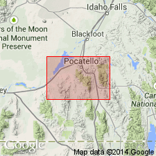
Little Creek Formation. Mainly basaltic tuff and breccia erupted from vent near Massacre Rocks. Thickness <75 feet (23 m). Unconformably underlies Massacre Volcanics. Recognized in Power County, southeastern Idaho. Age is considered late Pliocene or early Pleistocene. (Follows Trimble and Carr, 1976.)
Source: Publication.
For more information, please contact Nancy Stamm, Geologic Names Committee Secretary.
Asterisk (*) indicates published by U.S. Geological Survey authors.
"No current usage" (†) implies that a name has been abandoned or has fallen into disuse. Former usage and, if known, replacement name given in parentheses ( ).
Slash (/) indicates name conflicts with nomenclatural guidelines (CSN, 1933; ACSN, 1961, 1970; NACSN, 1983, 2005, 2021). May be explained within brackets ([ ]).