

- Usage in publication:
-
- Las Cruces formation
- Modifications:
-
- Named
- Dominant lithology:
-
- Limestone
- AAPG geologic province:
-
- Orogrande basin
Summary:
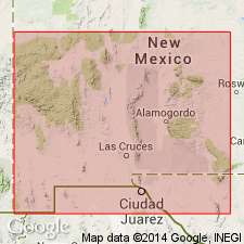
Named for town of Las Cruces, Dona Ana Co, NM. Type section designated on southwest side of small south fork of shallow canyon that leaves the west slope of Franklin Mountains, directly east of Vinton, TX, SW1/4 sec 67, Blk 82, El Paso Co, TX, Orogrande basin. Consists of hard, dense, black, sublithographic, even-bedded. gray-weathering, sparsely fossiliferous limestone beds that rest unconformably on the "black 'Percha' shale (Nelson, 1940--Canutillo formation)" and are unconformably overlain by Rancheria formation (new) with a conspicuous break in the Franklin Mountains. Is distinguished by relatively thin, remarkably even beds, from 4 to 16 in thick, averaging about 10 inches. Free of chert at type section. In this area no Caballero, Lake Valley (revised), or Kelly beds have been found, and Las Cruces rests directly on "Percha" shale. Little developed in NM; exposed mainly in Franklin Mountains, TX where it is a maximum of about 60 ft thick at type "area". Overlaps northward and is exposed in southern part of San Andres Mountains--Bear Canyon, Dona Ana Co, NM, Orogrande basin. May also be present in Hueco Mountains, but as yet it has not been recognized there or in the southern Sacramento Mountains. Very meager fauna similar to overlying Rancheria; lithologically quite similar to some parts of Rancheria. Differentiation of two difficult except at unusually good exposures. Mississippian (Meramec) age. Cross and measured sections.
Source: GNU records (USGS DDS-6; Denver GNULEX).
For more information, please contact Nancy Stamm, Geologic Names Committee Secretary.
Asterisk (*) indicates published by U.S. Geological Survey authors.
"No current usage" (†) implies that a name has been abandoned or has fallen into disuse. Former usage and, if known, replacement name given in parentheses ( ).
Slash (/) indicates name conflicts with nomenclatural guidelines (CSN, 1933; ACSN, 1961, 1970; NACSN, 1983, 2005, 2021). May be explained within brackets ([ ]).