- Usage in publication:
-
- Laramie River Complex*
- Modifications:
-
- Named
- Mapped 1:24k (Bull Camp Peak quad, Albany Co, WY)
- Dominant lithology:
-
- Gneiss
- Granodiorite
- AAPG geologic province:
-
- Southern Rocky Mountain region
Summary:
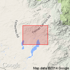
Type locality designated for exposures in gorge of Laramie River, for which unit is named, where river crosses Laramie Mountains in north-central Albany Co, WY (Southern Rocky Mountain region). Study area includes Dodge Ranch and part of Ayres Spring quads. Includes all unnamed monzogranite, leucocratic granitoid gneiss, and metamorphosed migmatitic granite in central Laramie Mountains. Includes five separately mapped units (ascending): hornblende granodiorite (Archean), microcline-augen granite gneiss (Archean), granite gneiss (Archean), pegmatite (Archean and Early Proterozoic), and quartz veins (Archean and Early Proterozoic). Hornblende granodiorite occurs as hand-specimen to outcrop-size inclusions in granite gneiss. Microcline-augen granite gneiss occurs locally on west side of Laramine Mountains; both intrudes and is intruded by granite gneiss. Granite gneiss is pink medium- to coarse-grained massive to layered granite, monzogranite, alaskite, and migmatitic gneiss. Pegmatite is very coarse grained granitic rock; swarms of pegmatite sills locally grade into swarms of granite gneiss sills. Quartz veins are white bull quartz. Older than Paleozoic or Late Proterozoic breccia; time equivalent to rocks of Kennedy dike swarm and Bluegrass Creek Metamorphic Suite (Snyder and others, in press, USGS I-2236). Part of Laramie River intrudes metamorphic rocks of Bluegrass Creek and are apophyses of Laramie batholith. Archean and Early Proterozoic age.
Source: GNU records (USGS DDS-6; Denver GNULEX).
For more information, please contact Nancy Stamm, Geologic Names Committee Secretary.
Asterisk (*) indicates published by U.S. Geological Survey authors.
"No current usage" (†) implies that a name has been abandoned or has fallen into disuse. Former usage and, if known, replacement name given in parentheses ( ).
Slash (/) indicates name conflicts with nomenclatural guidelines (CSN, 1933; ACSN, 1961, 1970; NACSN, 1983, 2005, 2021). May be explained within brackets ([ ]).

