The National Geologic Map Database is migrating to a new infrastructure. We apologize for any service disruptions during this process.
|
|---|


- Usage in publication:
-
- Laramie division
- Modifications:
-
- Overview
Summary:
Pg. 28, 58-65. Described Laramie division of the Cretaceous plains of Colorado east of the Colorado or Front Range. (Vol. 1, in which King defined the Laramie, was not published until 1878.) Hague gave thickness in eastern foothills of Colorado as 1,500 feet, and defined Laramie as unconformably overlain by Pliocene or Quarternary and as grading into underlying Fox Hills sandstone. His measured section was on Denver Pacific RR, 5 or 6 miles west of Carr Station and about 18 miles southeast of Cheyenne, Wyoming.
Source: US geologic names lexicon (USGS Bull. 896, p. 1150).
- Usage in publication:
-
- Laramie formation*
- Modifications:
-
- Revised
- AAPG geologic province:
-
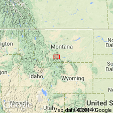
- Montana folded belt
Summary:
Is a coal-bearing sandstone and shale formation about 1,000 ft thick mapped in southern and west part of area (geologic map), Park Co, MT, Montana folded belt province. Extends along flanks of Snowy Mountains, Bridger and Little Belt Ranges. Recognized as the chief coal-bearing formation in the entire Rocky Mountain region. Underlain by the massive sandstone assigned to the Fox Hills [sandstone] and revised at its upper contact in that it is overlain unconformably by the newly named Cretaceous Livingston formation. The upper contact marks an abrupt lithologic change. Has marine Cretaceous fossils. Sandstones of the Laramie are characteristically poorly cemented, generally massive and cross-bedded, consisting mainly of quartz, mica, and accessory minerals from Archean rocks; they do not contain volcanic rock fragments. Plant remains present in the gray shales. Measured section of lower part near Bowers mine.
Source: GNU records (USGS DDS-6; Denver GNULEX).
- Usage in publication:
-
- Laramie formation*
- Modifications:
-
- Areal extent
- AAPG geologic province:
-
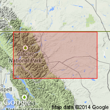
- Sweetgrass arch
Summary:
Occurs 10 mi east of Lower Saint Mary Lake, on Middle fork of Milk River, Glacier Co, MT on the Sweetgrass arch. Contains oysters belonging to Laramie fauna. Is of Cretaceous age.
Source: GNU records (USGS DDS-6; Denver GNULEX).
- Usage in publication:
-
- Laramie formation*
- Modifications:
-
- Areal extent
- AAPG geologic province:
-
- Powder River basin
- Williston basin
Summary:
Laramie formation uppermost Upper Cretaceous formation in Bighorn Mountains thought to underlie the plains between the foothills of the Bighorns to the Black Hills in the Powder River basin and Williston basin. Laramie lies in a broad flat-bottomed basin with steep dips on the west slope of the Bighorn uplift. Thickness is thought to be several thousand feet. Laramie rocks are the lower parts of the sequence composed of sandstone, sandy shale, and shale with numerous lignite beds. Has a lower part of alternating shale and thin-bedded, rusty sandstone. Lower part in northern region has a conglomerate of flat pebbles derived from the Deadwood formation. Conglomerate recognized from west of Sheridan south to Crazywoman Creek.
Source: GNU records (USGS DDS-6; Denver GNULEX).
- Usage in publication:
-
- Laramie formation*
- Modifications:
-
- Areal extent
- AAPG geologic province:
-
- Green River basin
Summary:
Mapped as "Laramie" formation on east flank of Rock Springs uplift, Sweetwater Co, WY, Greater Green River basin. Consists of sandstone, clay, and coal beds with massive basal bed of white and yellow sandstone with traces of conglomerate in places. Overlies Lewis shale; unconformably underlies post-"Laramie" formation rocks. Shown to be 1500 ft thick on stratigraphic chart. Cross sections. Late Cretaceous age.
Source: GNU records (USGS DDS-6; Denver GNULEX).
- Usage in publication:
-
- Laramie formation*
- Modifications:
-
- Revised
- AAPG geologic province:
-
- Denver basin
Summary:
Pg. 65-86. Discussion of Cretaceous-Tertiary boundary in Denver basin, Colorado. Stratigraphic and paleontologic evidence show that Laramie formation, Arapahoe formation, and the Cretaceous parts of Denver formation and Dawson arkose comprise a unit correlative with Lance formation and its equivalents. Proposed herein that the Laramie be redefined to include all the Upper Cretaceous sequence between top of Fox Hills and base of the Paleocene in Denver basin; that term Arapahoe as Arapahoe conglomerate member be retained for the conglomerate immediately overlying present Laramie formation; that terms Denver formation and Dawson arkose be restricted to the Tertiary strata. The Laramie as expanded is equivalent to typical Lance formation and Hell Creek formation; to Medicine Bow formation plus basal part of Raton formation with the exception that both the Medicine Bow and Vermejo as now defined may include in their basal parts some strata that should be referred to Fox Hills sandstone.
Source: US geologic names lexicon (USGS Bull. 1200, p. 2106-2107).
- Usage in publication:
-
- Laramie formation
- Modifications:
-
- Overview
- Areal extent
- AAPG geologic province:
-
- Denver basin
Summary:
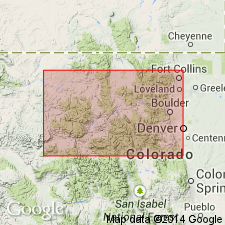
Laramie formation-Arapahoe formation contact in the Denver basin remains as defined by Emmons, Cross, and Eldridge in (1896). The contact is erosional separating clay of the Laramie from arkosic conglomerate of the Arapahoe. Mapped (geologic map) between Colorado Springs east to Black Squirrel Creek areas, and north of Matheson around mapped area to Ralston Creek area, CO in the Denver basin. Mapped locally at west edge of basin. Of Late Cretaceous age.
Source: GNU records (USGS DDS-6; Denver GNULEX).
- Usage in publication:
-
- Laramie formation*
- Modifications:
-
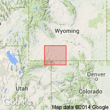
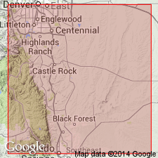
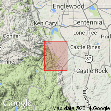
- Mapped 1:24k (Golden quad, Jefferson Co, CO)
- Dominant lithology:
-
- Sandstone
- Claystone
- AAPG geologic province:
-
- Denver basin
Summary:
Is Upper Cretaceous formation mapped in northern Jefferson Co, CO (Denver basin). Unconformably? overlies Fox Hills sandstone (Upper Cretaceous); unconformably? underlies Arapahoe formation (Upper Cretaceous). Laramie is steeply dipping, at places overturned, north striking in western part of quad; at places it is marked by low hogback and open pit clay mines. North of Ralston Creek, strike of upper part changes to almost due east, outlining shape of portion of Denver basin. Described as light- to medium-gray, medium- to fine-grained, quartzose sandstone, light- to medium-gray claystone, and some coal in lower 200 ft. Coal beds are discontinuous and range in thickness from thin laminae to 14 ft. Numerous fossil leaf fragments indicate terrestrial origin. Thickness is 600-700 ft.
Source: GNU records (USGS DDS-6; Denver GNULEX).

- Usage in publication:
-
- Laramie formation*
- Modifications:
-
- Mapped 1:24k (Littleton quad, Arapahoe, Douglas, and Jefferson Cos, CO)
- Dominant lithology:
-
- Siltstone
- Claystone
- Sandstone
- Coal
- AAPG geologic province:
-
- Denver basin
Summary:
Is Upper Cretaceous formation mapped in east-central Jefferson Co, CO (Denver basin). The only conspicuous outcrop is in SW/4 sec 27, T5S, R69W; is covered south of Deer Creek, but may be traced northward from Deer Creek nearly to north line of quad. Map unit consists of hard yellowish-gray medium-grained massive sandstone, soft light-gray sandstone, olive-gray siltstone and claystone, soft lignitic coal layers, and moderate-brown hard sandy ironstone layers that contain fossil leaves; thin conglomerate layers near middle of unit contain chertified or agatized pebbles. Overlies Fox Hills sandstone (Upper Cretaceous); underlies Dawson arkose (Upper Cretaceous and Paleocene). Thickness is about 600 ft.
Source: GNU records (USGS DDS-6; Denver GNULEX).
- Usage in publication:
-
- Laramie formation*
- Modifications:
-
- Mapped 1:24k (Kassler quad, Douglas and Jefferson Cos, CO)
- Dominant lithology:
-
- Siltstone
- Claystone
- Sandstone
- Coal
- AAPG geologic province:
-
- Denver basin
Summary:
Is Upper Cretaceous formation mapped in northwestern Douglas Co, CO (Denver basin). Outcrops as northwesterly striking, northeast dipping band parallel to Hogback in central part of map. Described (p. 104-106) as consisting of light olive-gray and pale yellowish-brown clayey shale, yellowish-gray friable well-graded sandstone, moderate-brown hard limonitic sandstone, moderate-brown hard limonitic conglomerate, white clean friable conglomerate; and brownish-black lignitic coal beds ranging from 0-6 ft thick. Measured sections. Best outcrops in center of sec 29, T7S, R689W and at Lehigh Mine along west border of sec 20, T7S, R68W and sec 7, T7S, R68W, but unit is generally covered. Overlies Fox Hills sandstone; underlies Dawson arkose. Basal contact not exposed. Contains abundant leaf prints along bedding planes of sandstone and ironstone beds near top including, FICUS ARENACEA, F. PLANICOSTATA, F. TRINERVIS, ANONA ROBUSTA, AND DOMBEYOPSIS SINUATA. Thickness is about 660 ft.
Source: GNU records (USGS DDS-6; Denver GNULEX).

- Usage in publication:
-
- Laramie Formation*
- Modifications:
-
- Mapped 1:24k (Morrison quad, Jefferson Co, CO)
- Dominant lithology:
-
- Siltstone
- Claystone
- Sandstone
- Conglomerate
- Coal
- AAPG geologic province:
-
- Denver basin
Summary:
Is Upper Cretaceous formation mapped in Jefferson Co, CO (Denver basin). Outcrops occur as narrow band on east side of Hogback. Upper part is light-gray micaceous siltstone stained yellowish orange, light-, olive-, and pinkish-gray silty claystone, grayish-brown lignitic claystone, minor white and yellowish-orange friable ridge-forming sandstone, and near top thin layers of conglomerate composed of pebbles of sedimentary rocks. Sand grains are quartz and chert. Yellowish-orange sandy ironstone concretions. Lower part is almost entirely yellowish-gray iron-stained and white "salt-and-pepper" friable sandstone composed of quartz, biotite mica, and kaolinized feldspar. Sandstone 110 ft thick at base is considered Fox Hills Sandstone by one [anonymous] authority. Gray sandstone contains gray shale chips. Contains thin ironstone layers and shale layers near base. Subbituminous coal beds as thick as 8 ft lie in lower 200 ft above basal sandstone. Abandoned coal mines are areas of potential subsidence, as in the valley south of Alameda Parkway. Gray or white claystone in beds more than 10 ft thick is used for manufacture of brick and tile. Contains fossil leaves, wood, and other plant remains. Thickness 550 ft. Overlies Fox Hills Sandstone (Upper Cretaceous). Unconformably underlies Arapahoe Formation (Upper Cretaceous), with local major uplift noted.
Source: GNU records (USGS DDS-6; Denver GNULEX).
- Usage in publication:
-
- Laramie Formation*
- Modifications:
-
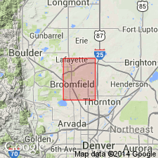
- Mapped 1:24k (Lafayette quad, Adams Boulder, and Jefferson Cos, CO)
- Dominant lithology:
-
- Shale
- Siltstone
- Claystone
- Coal
- Sandstone
- AAPG geologic province:
-
- Denver basin
Summary:
Is Upper Cretaceous formation mapped in northwestern Adams, southeastern Boulder, and northeastern Jefferson Cos, CO (Denver basin). Is oldest exposed unit in study area; unconformably underlies Arapahoe Formation (Upper Cretaceous). Outcrops in southwestern to northeastern parts of quad. Upper part of unit described as olive-gray to dark-grayish-brown shale, siltstone, lignitic claystone, and coal, interbedded with regularly bedded finely laminated light-gray to light-brown (weathered) sandstone. Several subbituminous coal beds up to 2 m thick occur near base of upper part. Lower part described as light-gray well-sorted fine- to medium-grained "salt-and-pepper" sandstone consisting of quartz and mica. Sandstones in lower part considered part of Fox Hills Sandstone by Spencer (1961, GQ-151) in Louisville quad to west. Coal has been mined in unit in Lafayette-Louisville-Broomfield area. Subsidence and collapse has occurred over some mined-out areas. Clay of Laramie is mostly kaolinite with lesser montmorillonite and illite. Thickness of upper part is about 183 m; lower part about 30-45 m.
Source: GNU records (USGS DDS-6; Denver GNULEX).
- Usage in publication:
-
- Laramie Formation*
- Modifications:
-
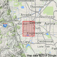
- Mapped 1:24k (Fort Logan quad, Arapahoe, Denver, and Jefferson Cos, CO)
- Dominant lithology:
-
- Sandstone
- Siltstone
- Claystone
- AAPG geologic province:
-
- Denver basin
Summary:
Is Upper Cretaceous formation mapped in eastern Jefferson Co, CO (Denver basin). Conformably overlies Fox Hills Sandstone (Upper Cretaceous); unconformably underlies Arapahoe Formation (Upper Cretaceous). Unit described as light-gray to yellowish-gray micaceous siltstone; pinkish-gray, gray and white silty claystone; yellowish-gray to medium-gray friable sandstone; and several lenticular subbituminous coal beds. Exposed only in extreme southwest corner of quad. Engineering properties discussed. Thickness ranges from 600 to over 900 ft reported in well logs from various parts of quad.
Source: GNU records (USGS DDS-6; Denver GNULEX).
- Usage in publication:
-
- Laramie Formation*
- Modifications:
-
- Biostratigraphic dating
- AAPG geologic province:
-
- Denver basin
Summary:
Newly defined palynostratigraphic zone MANCICORPUS STRIATUS Interval Zone is present in lower part of Laramie in northeastern CO [Denver basin]. M. STRIATUS is assigned latest Campanian through early Maastrichtian age (73 to 69 Ma). M. STRIATUS is equivalent to interval including zones of ammonites BACULITES REESIDEI through B. CLINOLOBATUS. Palynostratigraphic zone WODEHOUSEIA SPINATA Assemblage Zone is present in upper part of Laramie Formation in northeastern CO. W. SPINATA is late Maastrichtian age (69 to 65.5 Ma). The zone of ammonite HOPLOSCAPHITES NICOLLETI is present below lower boundary of W. SPINATA in stratotype in eastern MT and zone of dinosaur TRICERATOPS is present at top of zone in MT and WY. Zonation indicates Laramie is latest Campanian to late Maastrichtian age.
Source: GNU records (USGS DDS-6; Denver GNULEX).
- Usage in publication:
-
- Laramie Formation*
- Modifications:
-
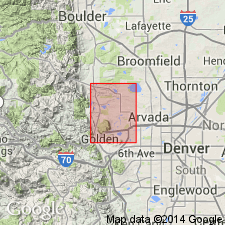
- Mapped 1:12k (Jefferson Co, CO)
- Dominant lithology:
-
- Claystone
- Sandstone
- Siltstone
- Coal
- AAPG geologic province:
-
- Denver basin
Summary:
Is Upper Cretaceous formation mapped in northern Jefferson Co, CO (Denver basin). Conformably overlies Fox Hills Sandstone (Upper Cretaceous); unconformably underlies Arapahoe Formation (Upper Cretaceous). Outcrops as isolated patches in eastern and western parts of map area. Upper part of unit is described as commonly consisting of olive-gray to moderate-yellowish-brown, massive claystone that is interlayered with laminated silty and sandy claystone and beds of light-olive-gray to dark-yellowish-orange, lenticular, very fine to fine-grained, silty sandstone, dark-gray to black, carbonaceous claystone, and black subbituminous coal about 0.5-1.2 m thick; deformed beds locally present near top. Lower part commonly consists of light-olive-gray to dark-yellowish-orange, thin to massive, very fine to medium-grained, moderate to well cemented sandstone and light-olive-gray to yellowish-orange, massive claystone interlayered with beds of laminated siltstone, silty claystone, lenticular sandstone, and discontinuous coal. Resistant sandstone in lower part forms prominent ridges extending from south of Golden northward to Marshall. Coal has been mined from unit at Capitol Mine in southwestern part of map area; clay has been mined from lower part in western part of map area. Thickness of upper part about 90-190 m; lower part about 45-100 m.
Source: GNU records (USGS DDS-6; Denver GNULEX).
For more information, please contact Nancy Stamm, Geologic Names Committee Secretary.
Asterisk (*) indicates published by U.S. Geological Survey authors.
"No current usage" (†) implies that a name has been abandoned or has fallen into disuse. Former usage and, if known, replacement name given in parentheses ( ).
Slash (/) indicates name conflicts with nomenclatural guidelines (CSN, 1933; ACSN, 1961, 1970; NACSN, 1983, 2005, 2021). May be explained within brackets ([ ]).