

- Usage in publication:
-
- Lake Killarney unit
- Modifications:
-
- Named
- Dominant lithology:
-
- Tuff
- Rhyolite
- Breccia
- AAPG geologic province:
-
- Midcontinent region
Summary:
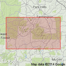
Named as an informal field term for typical exposures in area of Lake Killarney, for which unit is named, Iron Co, MO, Midcontinent region. Exposed in north-central, central, southeast and east-central parts of quad. Divided into lower, middle and upper zones. Lower zone is recognized at only two locations [not specified]; appears much like middle zone, except fiamme are much less abundant and feldspars may be altered to nearly same color as matrix and appear less abundant. Middle zone is porphyritic, light-maroon ash-flow tuff with locally abundant fiamme and with phenocrysts of quartz and pink alkali feldspar; fiamme are lighter in color than remainder of rock imparting foliated texture; local autobreccias and rare lithophysae imply presence of intercalated rhyolitic flows. Upper zone is usually a breccia though is tuff at some localities; breccia consists of light-brown, fine-grained, uniform matrix; clasts are moderately to well rounded consisting of silicic volcanic rocks and vary in abundance from 25-75% of zone; thickness of breccia ranges up to 30 m northwest of Lake Killarney. Thickness of Lake Killarney is 500-1500 m. Overlies undifferentiated volcanic rocks; underlies Grassy Mountain ignimbrite (new, informal). Petrographic description; generalized geologic map. Replaces in part Pilot Knob felsite and Stouts Creek Rhyolite as mapped by Tolman and Robertson (1969). Precambrian age.
Source: GNU records (USGS DDS-6; Denver GNULEX).
- Usage in publication:
-
- Lake Killarney Formation
- Modifications:
-
- Revised
- AAPG geologic province:
-
- Midcontinent region
Summary:
Lake Killarney Formation [treated as a formal unit in this report (not discussed)], basal formation (of 3) of /Butler Hill Group of /St. Francois Mountains Volcanic Supergroup (revised). Study area is St. Francois Mountains, southeast Missouri (Midcontinent region). Oldest unit of Butler Hill and oldest in St. Francois Mountains; underlies Grassy Mountain Ignimbrite (revised) of Butler Hill. Age is Precambrian Y. Nomenclature listed in table 1.
[Conflicts with nomenclature guidelines (ACSN, 1970; NACSN, 1983, 2005, 2021): name Butler Hill applied concurrently to two different units in same area; preempted by Butler Hill Granite of Tolman and Robertson (1969); name St. Francois Mountains applied concurrently to two different units in same area; a [supergroup] name combines a geographic name with the term ["supergroup,"] and no lithic designation is included.]
Source: Modified from GNU records (USGS DDS-6; Denver GNULEX).
- Usage in publication:
-
- Lake Killarney formation
- Modifications:
-
- Revised
- Overview
- AAPG geologic province:
-
- Midcontinent region
Summary:
Uppermost part is referred to as Anderson Mountain member (first used). [Not clear if authors intended Anderson Mountain or any stratigraphic units within study area to be formal or informal.] Lake Killarney is oldest known rock exposed in St. Francois Mountains, southeastern MO, in Midcontinent region. Consists of at least two ash flow sheets, one or two rhyolitic lava flows, and minor intercalated volcaniclastic sedimentary rock units. Most of unit is porphyritic dark-maroon ash flow tuff with phenocrysts of quartz and pink perthite; locally it has abundant crushed pumice fragments, and rarely displays autobreccia and lithophysae. Lake Killarney is at least 390 m thick. Older than Grassy Mountain ignimbrite. Table of stratigraphic units; geologic map. Most volcanic rocks of St. Francois Mountains are 1485 m.y. old (Proterozoic).
[Authors' intentions are unclear as to which, if any, of the geologic units discussed should have formal status.]
Source: GNU records (USGS DDS-6; Denver GNULEX).
- Usage in publication:
-
- Lake Killarney Formation
- Modifications:
-
- Overview
- AAPG geologic province:
-
- Midcontinent region
Summary:
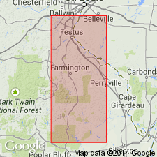
Mapped (fig. 1) in parts of Iron Mountain Lake and Graniteville quads, central St. Francois Mountains, MO, Midcontinent region. Occurs north, east and southeast of regional angular unconformity. (Rocks east and north of unconformity are older than rocks west of it). Divided into a lower member of crystal-poor rhyolitic tuff with locally abundant secondary flow structures and an upper member of crystal-poor tuff with abundant xenoliths. Maximum thickness is 520 m in southern part of study area and thickens to south of study area. Petrologic data. Oldest exposed unit in mapped area; underlies Grassy Mountain Ignimbrite. Proterozoic age (1440-1480 Ma).
Source: GNU records (USGS DDS-6; Denver GNULEX).
For more information, please contact Nancy Stamm, Geologic Names Committee Secretary.
Asterisk (*) indicates published by U.S. Geological Survey authors.
"No current usage" (†) implies that a name has been abandoned or has fallen into disuse. Former usage and, if known, replacement name given in parentheses ( ).
Slash (/) indicates name conflicts with nomenclatural guidelines (CSN, 1933; ACSN, 1961, 1970; NACSN, 1983, 2005, 2021). May be explained within brackets ([ ]).