


- Usage in publication:
-
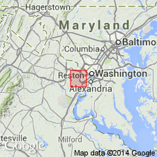
- Lake Barcroft Metasandstone*
- Modifications:
-
- Named
- Dominant lithology:
-
- Metasandstone
- Metagraywacke
- AAPG geologic province:
-
- Piedmont-Blue Ridge province
Summary:
The Lake Barcroft Metasandstone is here named as the upper unit of the Eastern Fairfax sequence in northern Virginia. It consists of two types of metasandstone: Type I meta-arenite, thick-bedded quartzofeldspathic granofels without interbedded pelite; Type II thin- to medium-bedded micaceous metagraywacke with pelitic layers. Gradationally overlies the Accotink Schist of the Eastern Fairfax sequence; underlies the Sykesville Formation, which contains exotic blocks of Lake Barcroft Metasandstone, and which is believed to have been emplaced by subaqueous sliding on the top of the Lake Barcroft. Intruded by Early Cambrian Occoquan Granite. Thickness is about 400 m.
Source: GNU records (USGS DDS-6; Reston GNULEX).
- Usage in publication:
-
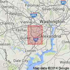
- Lake Barcroft Metasandstone*
- Modifications:
-
- Revised
- AAPG geologic province:
-
- Piedmont-Blue Ridge province
Summary:
The Lake Barcroft Metasandstone is the upper unit of the here named Annandale Group, originally the informal Eastern Fairfax sequence of Drake and Lyttle (1981). The lower unit of the Annandale Group, the Accotink Schist, and the Lake Barcroft lie between two melanges, the lower newly recognized Indian Run Formation and the upper Sykesville Formation. Fragments of Accotink and Lake Barcroft are restricted to a certain area of melange originally defined as Sykesville, but now considered to be a separate unit, the Indian Run. Age is Late Proterozoic or Cambrian.
Source: GNU records (USGS DDS-6; Reston GNULEX).
- Usage in publication:
-
- Lake Barcroft Metasandstone*
- Modifications:
-
- Age modified
- Geochronologic dating
Summary:
The age of the Annandale Group, including the Accotink Schist and Lake Barcroft Metasandstone, is now believed to be Late Proterozoic and (or) Early Cambrian because the Annandale Group has had a much more complicated geologic history than the younger Popes Head Formation, which unconformably overlies it, and the precursory melanges, the Sykesville and Indian Run Formations. All the lithotectonic units in the area are intruded by the Occoquan Granite, which may be as young as Late Cambrian, based on a Sr-Rb age of 494 + 14 Ma.
Source: GNU records (USGS DDS-6; Reston GNULEX).
For more information, please contact Nancy Stamm, Geologic Names Committee Secretary.
Asterisk (*) indicates published by U.S. Geological Survey authors.
"No current usage" (†) implies that a name has been abandoned or has fallen into disuse. Former usage and, if known, replacement name given in parentheses ( ).
Slash (/) indicates name conflicts with nomenclatural guidelines (CSN, 1933; ACSN, 1961, 1970; NACSN, 1983, 2005, 2021). May be explained within brackets ([ ]).