

- Usage in publication:
-
- Laguna formation*
- Modifications:
-
- Named
- Dominant lithology:
-
- Silt
- Sand
- Gravel
- AAPG geologic province:
-
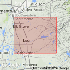
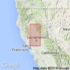
- Sacramento basin
Summary:
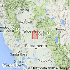
Named for basin of Laguna Creek. Type section designated as exposures in north bank of Hadselville Creek short distance upstream from junction with Laguna Creek about 1 mi northeast of Clay post office, NE/4 NE/4 sec.25 T6N R7E, San Joaquin Co, CA. Consists of stream-borne silt and sand with some gravel and presumably some clay; nonandesitic; poorly bedded and poorly exposed. Thickness ranges from 0 to 400 ft. Unconformably underlies Arroyo Seco gravel (new) of Pleistocene age; overlies Mehrten formation (new) of Miocene and Pliocene(?) age. Shown on geologic and hydrologic map of map of Mokelumne area, CA, as of Pliocene(?) age. "presumably it is the product of Pliocene and possibly the early Pleistocene epochs", p.60
Source: GNU records (USGS DDS-6; Menlo GNULEX).
- Usage in publication:
-
- Laguna formation*
- Modifications:
-
- Overview
- AAPG geologic province:
-
- Sacramento basin
Summary:
"The Laguna formation is probably Pliocene and possibly, in part, Pleistocene in age (Piper and others, 1939, p.60)." Measured section in bluff on north bank of American River just east of bridge at Fair Oaks is described with thickness of 56 ft. Shown on geologic map of Sacramento Valley as undivided with related continental deposits.
Source: GNU records (USGS DDS-6; Menlo GNULEX).
- Usage in publication:
-
- Laguna Formation*
- Modifications:
-
- Areal extent
- Revised
- AAPG geologic province:
-
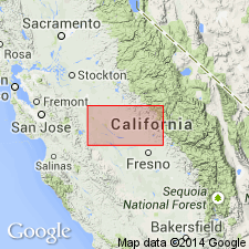
- San Joaquin basin
Summary:
Geographically extended into Merced and Stanislaus Cos, CA where overlies Mehrten Formation, is truncated by North Merced Gravel (Arkley, 1962) and consists of granitic alluvium ranging from gravel to fine silt. Reference section for lower unit designated 11 km north of Merced, just east of Oakdale Road, NE/4 NW/4 sec.25 T6S R13E, Winton and Yosemite Lake 7.5' quads, Merced Co, CA. Another reference section for lower unit is at NE/4 NW/4 sec.25 T6S R13E, Yosemite Lake 7.5' quad. China Hat Gravel member designated as local, uppermost member of upper unit of Laguna Formation. Shown on geologic map of Merced-Madera area, San Joaquin Co, CA. Age is Pliocene probably between 4 and 3 Ma based on stratigraphic relations and preliminary paleomagnetic studies (K.L. Verosub, oral commun., 1980).
Source: GNU records (USGS DDS-6; Menlo GNULEX).
- Usage in publication:
-
- Laguna Formation*
- Modifications:
-
- Revised
- AAPG geologic province:
-
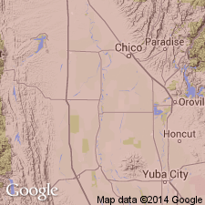
- Sacramento basin
Summary:
Nomlaki Tuff Member identified in the lower part of Laguna Formation around Oroville and points south to the Yuba River and Beale Air Force Base. Nomlaki identification based on trace-element content of its glass. Age is Pliocene.
Source: GNU records (USGS DDS-6; Menlo GNULEX).
- Usage in publication:
-
- Laguna Formation*
- Modifications:
-
- Age modified
- AAPG geologic province:
-
- Sacramento basin
Summary:
Best estimates of age of Laguna Formation at Oroville, based on tephrochronology, paleomagnetic stratigraphy, and soil development are: deposition of lower unit from about 3.4(?) to 3.2 Ma; deposition of upper unit, possibly beginning about 2.6 Ma and concluding with deposition of uppermost gravel bed about 1.7 Ma or possibly 0.9 Ma. Shown on generalized geologic map of study area. Age given as Pliocene and Pleistocene.
Source: GNU records (USGS DDS-6; Menlo GNULEX).
For more information, please contact Nancy Stamm, Geologic Names Committee Secretary.
Asterisk (*) indicates published by U.S. Geological Survey authors.
"No current usage" (†) implies that a name has been abandoned or has fallen into disuse. Former usage and, if known, replacement name given in parentheses ( ).
Slash (/) indicates name conflicts with nomenclatural guidelines (CSN, 1933; ACSN, 1961, 1970; NACSN, 1983, 2005, 2021). May be explained within brackets ([ ]).