

- Usage in publication:
-
- La Bonte Gabbro*
- Modifications:
-
- Named
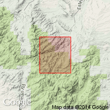
- Mapped 1:24k
- Dominant lithology:
-
- Gabbro
- AAPG geologic province:
-
- Northern Rocky Mountain region
Summary:
Named for La Bonte Creek. Type area is a composite of exposures at 1) coarse-grained phase--NE1/4 NE1/4 sec 22, T29N, R72W, 2) fine-grained chilled contact phase--SE1/4 sec 29, T29N, R72W, 3) fine-grained chilled contact phase--NW1/4 SW1/4 SW1/4 sec 12, T28N, R73W, Converse Co, WY in the Northern Rocky Mountain region. Consists of greenish-black (fresh), generally amphibolitized, chinopyroxene-plagioclase diabase. Is well exposed throughout its extent. Covered by younger deposits at northeast end. Covered by diabase boulders at southwest end. Predominantly gabbroic in composition but extends into dioritic composition. Plagioclase crystals occur in a mesh-like diabasic texture, and are usually fresh and unaltered. Also contains magnetite-ilmenite, pyrite-pyrrohite, quartz and biotite, minor sphene, carbonate, apatite, alkali feldspar, orthopyroxene and olivine. Is a lamellar intrusion in Archean granite and the largest clinopyroxene gabbro body (about 1 and one-third sq m) known in the Laramie Mountains. Mapped 1:24k in southern Converse and northern Albany Cos, WY (Northern Rocky Mountain region). Not dated directly. May have been intruded during or prior to an Early Proterozoic regional metamorphism responsible for amphibolitization. May be Late Archean and metamorphosed more than once. Cut by a Late Archean and Early Proterozoic dike. Cuts a Late Archean and Early Proterozoic dike.
Source: GNU records (USGS DDS-6; Denver GNULEX).
For more information, please contact Nancy Stamm, Geologic Names Committee Secretary.
Asterisk (*) indicates published by U.S. Geological Survey authors.
"No current usage" (†) implies that a name has been abandoned or has fallen into disuse. Former usage and, if known, replacement name given in parentheses ( ).
Slash (/) indicates name conflicts with nomenclatural guidelines (CSN, 1933; ACSN, 1961, 1970; NACSN, 1983, 2005, 2021). May be explained within brackets ([ ]).