

- Usage in publication:
-
- Kukpowruk formation*
- Modifications:
-
- Named
- Biostratigraphic dating
- Dominant lithology:
-
- Shale
- Siltstone
- Sandstone
- AAPG geologic province:
-
- Alaska Northern region
Summary:
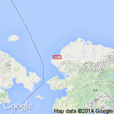
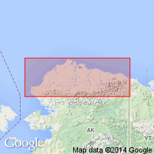
Named from Kukpowruk River as formation in Nanushuk group. Type locality designated along Kukpowruk River between 162 deg 42'W and 162 deg 44'W about 34 mi above mouth of river, northwestern AK, also location of measured type section. Best exposed in Utukok-Corwin area. Is largely marine inshore deposit of interbedded shale, siltstone, and sandstone with minor amounts of claystone, conglomerate, and carbonaceous shale. Thins eastward and northward from about 5000 ft on upper Kukpowruk River to about 2000 ft along lower Utukok River. Base of unit rises in stratigraphic section by intertonguing with Torok formation as traced northward. Basal contact placed at lowest persistent sandstone beds. Underlies nonmarine Corwin formation of Nanushuk group with gradational contact. Megafossils indicate late Early Cretaceous age (middle and upper(?) Albian) according to R.W. Imlay.
Source: GNU records (USGS DDS-6; Menlo GNULEX).
- Usage in publication:
-
- Kukpowruk formation*
- Modifications:
-
- Overview
- AAPG geologic province:
-
- Alaska Northern region
Summary:
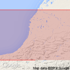
Detailed measured type section along Kukpowruk River on south flank of Kasegaluk syncline is over 2165 ft thick. Another section is described on south limb of Barbara syncline 11 mi north of type section. Report includes detailed information on distribution, thicknesses, lithology, fossils and their localities.
Source: GNU records (USGS DDS-6; Menlo GNULEX).
- Usage in publication:
-
- Kukpowruk Formation†
- Modifications:
-
- Abandoned
- AAPG geologic province:
-
- Alaska Northern region
Summary:
Pg. 5 (fig. 4), 6-8 (table 1), 12. †Kukpowruk Formation of Nanushuk Group. Abandoned. Rocks reassigned to unnamed lower part (marine) of Nanushuk Formation (revised). [See Nanushuk.]
Source: Publication.
For more information, please contact Nancy Stamm, Geologic Names Committee Secretary.
Asterisk (*) indicates published by U.S. Geological Survey authors.
"No current usage" (†) implies that a name has been abandoned or has fallen into disuse. Former usage and, if known, replacement name given in parentheses ( ).
Slash (/) indicates name conflicts with nomenclatural guidelines (CSN, 1933; ACSN, 1961, 1970; NACSN, 1983, 2005, 2021). May be explained within brackets ([ ]).