

- Usage in publication:
-
- Kineo rhyolite
- Modifications:
-
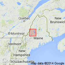
- Areal extent
- Dominant lithology:
-
- Rhyolite
- AAPG geologic province:
-
- New England province
Perkins, E.H., 1925, Contributions to the geology of Maine; Number 2, Part I, The Moose River sandstone and its associated formations: American Journal of Science, 5th series, v. 10, no. 58, p. 368-375.
Summary:
Pg. 371. Kineo rhyolite. An intrusion of rhyolite locally known as "Kineo flint." Forms a line of hills from Blue Ridge on southwest through Mount Kineo [Moosehead Lake quadrangle], Shaw Mountain, and Little Kineo to Table Mountain, Piscataquis County, western Maine. [Age is Devonian. On 1933 geol. map of Maine, by Arthur Keith, this rhyolite is assigned to Devonian.]
Name is credited to Professor E.S.C. Smith of Union College [see entry under Smith].
Source: Publication; US geologic names lexicon (USGS Bull. 896, p. 1097).
- Usage in publication:
-
- Kineo rhyolite
- Modifications:
-
- Principal reference
- Dominant lithology:
-
- Rhyolite
- AAPG geologic province:
-
- New England province
Smith, E.S.C., 1925, Contributions to the geology of Maine; Number 2, Part II, The igneous rock of Mt. Kineo and vicinity: American Journal of Science, 5th series, v. 10, no. 59, p. 437-444.
Summary:
Pg. 440-444. Kineo rhyolite. Of post-Oriskany age. Cuts Moose River sandstone, of Oriskany age. Splendid outcrops near Mount Kineo hotel, [eastern side of Mount Kineo], Moosehead Lake 15-min quadrangle, Piscataquis County, western Maine. [Age is Devonian. On 1933 geol. map of Maine, by Arthur Keith, this rhyolite is assigned to Devonian.]
Source: US geologic names lexicon (USGS Bull. 896, p. 1097).
- Usage in publication:
-
- Kineo volcanic member*
- Modifications:
-
- Revised
- Dominant lithology:
-
- Volcanics
- Tuff
- Breccia
- Conglomerate
- AAPG geologic province:
-
- New England province
Summary:
Pg. 155-156, 161, 162, 163-165, pl. 34 (geologic map). Kineo volcanic member of Tomhegan formation (new) of Moose River group. Consists of: blue-gray, bone-white-weathering, massive, conchoidally fractured felsite with quartz and feldspar phenocrysts; blue-gray, greenish-white-weathering, irregularly fractured felsite with garnet and white feldspar phenocrysts; dark-blue-gray, greenish-white to light-gray-weathering tuff; blue-gray, chalky-white-weathering tuff containing felsite and pumice fragments and fine-grained volcanic debris (devitrified shards); rhyolitic felsite pebble conglomerate; and flow breccia resembling the felsite but containing numerous irregular felsite fragments in a matrix of same material. Thickness ranges from 0 to 4,000 feet. Underlies main part of Tomhegan formation; overlies Tarratine formation. Age is Devonian, but further subdivision is uncertain; could be at least partially contemporaneous with basal part of main part of Tomhegan.
Source: Publication; GNU records (USGS DDS-6; Reston GNULEX).

- Usage in publication:
-
- Kineo Volcanic Member*
- Modifications:
-
- Revised
- AAPG geologic province:
-
- New England province
Summary:
Revised to include rocks previously mapped as both Heald Mountain Rhyolite and Kineo Volcanic Member of Boucot and Heath (1969). Exposed in Long Pond and Pierce Pond 15-min quads. Consists of weakly metamorphosed rhyolite ash-flow tuff, flows, domes, volcanic breccia, grit, and conglomerate as well as associated hypabyssal, garnet-bearing felsic intrusive rocks. Separately mapped intrusive garnet rhyolite in Tomhegan Formation, previously mapped as both unnamed garnet rhyolite and garnet rhyolite of the Kineo Volcanic Member by Boucot and Heath (1969), is now considered to be equivalent to Kineo.
Source: GNU records (USGS DDS-6; Reston GNULEX).
For more information, please contact Nancy Stamm, Geologic Names Committee Secretary.
Asterisk (*) indicates published by U.S. Geological Survey authors.
"No current usage" (†) implies that a name has been abandoned or has fallen into disuse. Former usage and, if known, replacement name given in parentheses ( ).
Slash (/) indicates name conflicts with nomenclatural guidelines (CSN, 1933; ACSN, 1961, 1970; NACSN, 1983, 2005, 2021). May be explained within brackets ([ ]).