- Usage in publication:
-
- Kidderville Formation
- Modifications:
-
- Not used
- AAPG geologic province:
-
- New England province
Summary:
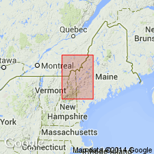
On basis of mapping done since about 1980, most rocks of the Kidderville Formation of Hatch (1963) in Dixville, NH, 15-min quad are here reassigned to Silurian Frontenac Formation of Piermont-Frontenac allochthon, and to Lower Devonian Ironbound Mountain Formation of Seboomook Group (rank raised). Small parts of Kidderville are also assigned to Silurian Perry Mountain and Rangeley Formations of the allochthon. In Dixville quad, rocks assigned to Kidderville by Hatch (1963) are exposed mainly east of Monroe fault and west of south end of Thrasher Peaks fault. Just east of Monroe fault is narrow belt of metabasalt and overlying volcanic and sedimentary facies, both of Frontenac Formation. These rocks are underlain farther east by thin belt of rocks assigned to Perry Mountain and Rangeley Formations. Structurally, central belt of volcanic and sedimentary facies defines troughline of north-trending faulted syncline; these rocks represent distal facies of proximal bimodal volcanic facies of Frontenac exposed on strike to the northeast. Easternmost belt of Hatch's (1963) Kidderville contains gray slate identical to that of type Ironbound Mountain Formation; it also contains (ascending) siltstone and shale facies, felsic volcanic member, and euxinic shale member of Ironbound Mountain Formation. Accordingly, Kidderville is not used on this map. [This report does not abandon the name Kidderville.]
Source: GNU records (USGS DDS-6; Reston GNULEX).
For more information, please contact Nancy Stamm, Geologic Names Committee Secretary.
Asterisk (*) indicates published by U.S. Geological Survey authors.
"No current usage" (†) implies that a name has been abandoned or has fallen into disuse. Former usage and, if known, replacement name given in parentheses ( ).
Slash (/) indicates name conflicts with nomenclatural guidelines (CSN, 1933; ACSN, 1961, 1970; NACSN, 1983, 2005, 2021). May be explained within brackets ([ ]).

