

- Usage in publication:
-
- Kibbey sandstone*
- Modifications:
-
- Areal extent
- Dominant lithology:
-
- Sandstone
- Gypsum
- AAPG geologic province:
-
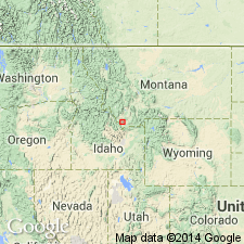
- Sweetgrass arch
Summary:
Kibbey sandstone. Lowest beds of Quadrant formation in this quadrangle are reddish and yellow clayey sandstones, often holding interbedded layers of gypsum and constituting Kibbey sandstone, which is 153 feet thick near Riceville. These are overlain by Otter shales [= Otter Creek shales of Weed, 1892], holding interbedded limestones, and forming upper member of Quadrant in this quadrangle. The Kibbey sandstone rests on Madison limestone. [Age is Late Mississippian.]
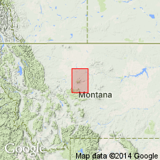
[Quadrant formation mapped over large area at and around Kibbey, which is on Little Otter Creek, in southwestern corner of quadrangle.]
Source: Publication; US geologic names lexicon (USGS Bull. 896, p. 1091).
- Usage in publication:
-
- Kibbey formation
- Modifications:
-
- Revised
- AAPG geologic province:
-
- Central Montana uplift
Summary:
Pg. 1026-1027. Kibbey sandstone. Included in Big Snowy group (new). [Age is Late Mississippian.]
Source: US geologic names lexicon (USGS Bull. 1200, p. 2005).

- Usage in publication:
-
- Kibbey sandstone member*
- Modifications:
-
- Adopted
- AAPG geologic province:
-
- Central Montana uplift
- Sweetgrass arch
Summary:
The USGS adopted Kibbey sandstone member of Quadrant formation in 1907. Recognized in Great Falls-Fort Benton region, central northern Montana. Age is Late Mississippian.
See entry under Scott (1935), who treats this as basal formation of his Big Snowy group.
Source: US geologic names lexicon (USGS Bull. 896, p. 1091).
- Usage in publication:
-
- Kibbey sandstone*
- Modifications:
-
- Areal extent
- AAPG geologic province:
-
- Central Montana uplift
Summary:
Pg. 333 (fig. 2), 334 (fig. 3), 341-342, 346-347. Kibbey sandstone of Big Snowy group. Thickness 220 feet in composite standard section of revised Big Snowy group. Underlies Otter formation; unconformably overlies Mission Canyon limestone of Madison group. [Age is Late Mississippian.]
Source: US geologic names lexicon (USGS Bull. 1200, p. 2005).
- Usage in publication:
-
- Kibbey Formation*
- Modifications:
-
- Age modified
- AAPG geologic province:
-
- Williston basin
- Central Montana uplift
- Powder River basin
Summary:
Is basal formation of revised Big Snowy Group, a group restricted to Kibbey, Otter and Heath (top) Formations, generally all of Chester, or Late Mississippian age. Kibbey generally considered to be Chester age as in places Kibbey unconformably overlies rocks of Meramec age or older (including Charles Formation or Madison Group); in other places (see line D-D', plate 2, western Williston basin in eastern MT) basal part of Kibbey interfingers with uppermost Charles Formation, suggesting late Meramec age. Is 220 ft thick at reference section of Amsden Group. Ranges from 147 ft thick at its type to 275 ft thick in Williston basin. Eastward thickening due to facies change from red beds of Kibbey to green shale of overlying Otter. Measured sections. Correlation charts. Cross sections. Areal limits in Powder River and Williston basins, Central Montana uplift, and Sweetgrass arch shown on map.
Source: GNU records (USGS DDS-6; Denver GNULEX).
- Usage in publication:
-
- Kibbey Sandstone*
- Modifications:
-
- Revised
- Age modified
- AAPG geologic province:
-
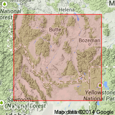
- Montana folded belt
Summary:
Assigned from Big Snowy Group to Snowcrest Range Group (new) as its lowest formation in Beaverhead Co, MT in the Montana folded belt province. Overlies the newly named McKenzie Canyon Limestone of Tendoy Group (new) and underlies Lombard Limestone (new) of Snowcrest Range. Consists of 76 m of yellow siltstone, sandstone, and mudstone that were deposited in shallow-water, probably lagoonal, environment. Is of middle Meramecian, Late Mississippian age (conodonts, plant fossils). Definition of Snowcrest Range Group is in Chapter B. Composite section. Geologic map. Correlation chart.
Source: GNU records (USGS DDS-6; Denver GNULEX).
- Usage in publication:
-
- Kibbey Sandstone*
- Modifications:
-
- Revised
- AAPG geologic province:
-
- Montana folded belt
Summary:
Pg. B1-B2, fig. 1. Kibbey Sandstone of Snowcrest Range Group (new). In Beaverhead and Madison Counties, southwest Montana, Kibbey is basal formation of the carbonate-dominated Snowcrest Range Group. Underlies Lombard Limestone (new) of Snowcrest Range Group. In Tendoy Mountains overlies McKenzie Canyon Limestone of Tendoy Group; east of Tendoys overlies Mission Canyon Limestone of Madison Group. In central Montana, Kibbey is basal formation of the clastic-dominated Big Snowy Group. Age is Mississippian.
Source: Publication.
For more information, please contact Nancy Stamm, Geologic Names Committee Secretary.
Asterisk (*) indicates published by U.S. Geological Survey authors.
"No current usage" (†) implies that a name has been abandoned or has fallen into disuse. Former usage and, if known, replacement name given in parentheses ( ).
Slash (/) indicates name conflicts with nomenclatural guidelines (CSN, 1933; ACSN, 1961, 1970; NACSN, 1983, 2005, 2021). May be explained within brackets ([ ]).