

- Usage in publication:
-
- Kau volcanic series*
- Modifications:
-
- Named
- Dominant lithology:
-
- Basalt
- AAPG geologic province:
-
- Hawaii
Summary:
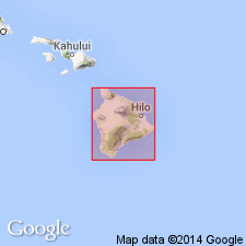
Named for Kau District. Type section: western wall of Mokuaweowea Caldera [19 deg 28' 46"N, 155 deg 35' 30"W, Mauna Loa 7.5' quad, Mauna Loa Volcano, Island of Hawaii, HI]. Formerly the Kau and Puna volcanic series were included in same unit, Kamehame basalt [now abandoned]. Covers most of surface of Mauna Loa Volcano. Comprises basaltic lava flows, both pahoehoe and aa, and few thin intercalated ash beds; olivine basalt predominates with lesser amounts of basalt and picrite-basalt (oceanite). Thickness at type is 410 ft, elsewhere as much as 600 ft. Overlies Pahala ash and Kahuku volcanic series. Interfingers with lavas of Hualalai and Kilauea Volcanoes. Map divides prehistoric member from historic (1832-1942) member and shows overlain by Quaternary alluvium and talus. Assigned late Pleistocene and Recent age.
Source: GNU records (USGS DDS-6; Menlo GNULEX).
- Usage in publication:
-
- Kau volcanic series*
- Modifications:
-
- Mapped
- AAPG geologic province:
-
- Hawaii
Summary:
Flows of Mauna Loa Volcano, mapped in Kilauea Crater 7.5' quad, include: (1) prehistoric lava flows; Keamoku lava flows, flows of Kipuka Maunaiu, flows of Kipuka Pakekake, and lower lava of Mauna Loa (rocks mapped in this unit are included in Kahuku and Kau volcanic series as defined by Stearns and Macdonald, 1946); (2) alluvium composed of debris washed down slopes between Kilauea and Mauna Loa; and (3) product of 1880 eruption.
Source: GNU records (USGS DDS-6; Menlo GNULEX).
- Usage in publication:
-
- Kau Volcanic Series*
- Modifications:
-
- Mapped
- AAPG geologic province:
-
- Hawaii
Summary:
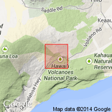
Historic flows from 1851, 1877(?), 1880(?), 1926, 1933, 1935, 1940, 1942, and 1950 and prehistoric flows of Kau Volcanic Series are mapped in Mauna Loa 7.5' quad. All rocks in quad belong to Kau Volcanic Series. All are members of tholeiitic series. Most contain few phenocrysts of olivine. Both pahoehoe and aa are present. Spatter cones include largest of 1940, about 170 ft high. Phreatic explosion debris occurs near E and W margin of Mokuaweoweo.
Source: GNU records (USGS DDS-6; Menlo GNULEX).
- Usage in publication:
-
- Kau Volcanic Series*
- Modifications:
-
- Mapped
- AAPG geologic province:
-
- Hawaii
Summary:
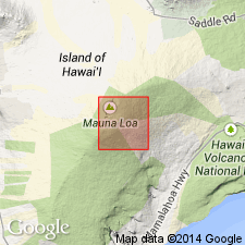
Flows of Mauna Loa Volcano which include Kau Volcanic Series, divided into historic lava flow of 1880 and prehistoric flows, are mapped in Kipuka Pakekake 7.5' quad. Except for tiny patch of Pahala Ash along south boundary of quad, all rocks belong to Kau Volcanic Series.
Source: GNU records (USGS DDS-6; Menlo GNULEX).
- Usage in publication:
-
- Kau Volcanic Series*
- Modifications:
-
- Age modified
- AAPG geologic province:
-
- Hawaii
Summary:
"Flow number 1" at the bottom of the section can be no older than 10,000 yrs, the age of the underlying Pahala Ash.
Source: GNU records (USGS DDS-6; Menlo GNULEX).

- Usage in publication:
-
- Kau Formation
- Modifications:
-
- Revised
- AAPG geologic province:
-
- Hawaii
Summary:
Kau Volcanic Series renamed Kau Formation in chart [to conform with Code]. Assigned Holocene age.
Source: GNU records (USGS DDS-6; Menlo GNULEX).
- Usage in publication:
-
- Kau Volcanics*
- Modifications:
-
- Revised
- AAPG geologic province:
-
- Hawaii
Summary:
Name changed from Kau Volcanic Series to Kau Volcanics. Historic eruptions are described. Flows divided into 5 informal units based on stratigraphic sequence, weathering characteristics, and Carbon-14 ages: (youngest to oldest) unit 1 flows overlies Pahala Ash, area of 209 sq km, age of >30,000 to 3,000 yr B.P.; unit 2, 589 sq km, age of 3,000 to 1500 yr B.P.; unit 3, 372 sq km, 1500 to 750 yr B.P.; unit 4, 224 sq km, 750 to 150 yr B.P.; and unit 5, 10 sq km, 150 to 0 yr B.P.
Source: GNU records (USGS DDS-6; Menlo GNULEX).

- Usage in publication:
-
- Kau Basalt*
- Modifications:
-
- Redescribed
- AAPG geologic province:
-
- Hawaii
Summary:
Kau Volcanics of Lipman (1970) changed to Kau Basalt to indicate lithology and shield-stage lava of tholeiitic, olivine tholeiitic, and picritic tholeiitic basalt.
Source: GNU records (USGS DDS-6; Menlo GNULEX).
For more information, please contact Nancy Stamm, Geologic Names Committee Secretary.
Asterisk (*) indicates published by U.S. Geological Survey authors.
"No current usage" (†) implies that a name has been abandoned or has fallen into disuse. Former usage and, if known, replacement name given in parentheses ( ).
Slash (/) indicates name conflicts with nomenclatural guidelines (CSN, 1933; ACSN, 1961, 1970; NACSN, 1983, 2005, 2021). May be explained within brackets ([ ]).