- Usage in publication:
-
- Josephine Peridotite*
- Modifications:
-
- Adopted
- Areal extent
- Dominant lithology:
-
- Peridotite
- AAPG geologic province:
-
- Klamath Mountains province
Summary:
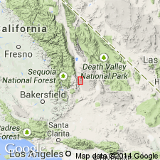
["Josephine peridotite sheet" of Wells and others (1949, Oregon Dept. of Geol. and Min. Indust. Bull. 40) is adopted as Josephine Peridotite. Wells and others describe sheet as covering more than 225 sq mi and as widest at latitude of Hawks Rest and Josephine Mountain (sec.20 T39S R9W, Chetco Peak quad, Josephine Co, OR)]. Includes westward extension of Josephine Peridotite called "Vulcan Peak peridotite" by Himmelberg and Loney (1973). Distribution in southwest OR and northwest CA shown on index sketch map and Vulcan Peak area map. Geologic sketch map and cross section of Dry Butte area describes unit as harzburgite, subordinate dunite, and minor orthopyroxenite. Unit is thrust northward over gabbroic terrane (called Chetco River complex by Hotz, 1971). Unit is thrust westward over Dothan Formation along Valen Lake thrust fault. Age given as Jurassic or older.
Source: GNU records (USGS DDS-6; Menlo GNULEX).
For more information, please contact Nancy Stamm, Geologic Names Committee Secretary.
Asterisk (*) indicates published by U.S. Geological Survey authors.
"No current usage" (†) implies that a name has been abandoned or has fallen into disuse. Former usage and, if known, replacement name given in parentheses ( ).
Slash (/) indicates name conflicts with nomenclatural guidelines (CSN, 1933; ACSN, 1961, 1970; NACSN, 1983, 2005, 2021). May be explained within brackets ([ ]).

