


- Usage in publication:
-
- Jonesboro limestone*
- Modifications:
-
- Original reference
- Dominant lithology:
-
- Limestone
- AAPG geologic province:
-
- Appalachian basin
Summary:
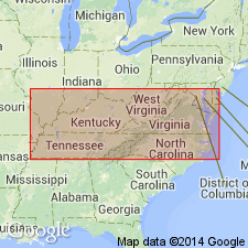
Pg. 564, 637, 671-674, pl. 27. Jonesboro limestone. Thin to moderately thick-bedded, usually fine-grained and in part magnesian limestone of Canadian age is found rather generally in eastern or Athens trough south of Lexington, Virginia. In southwestern Virginia and in eastern Tennessee as far south at least as Greenville, this limestone rests on Upper Cambrian. Nolichucky shale and hitherto has always been described as a sparingly cherty representative of Knox dolomite. It is a great valley maker in this region and very thick. I have measured it at only one place, namely, Jonesboro, Tennessee, where the formation though incomplete above, reaches thickness of 1,850+/- feet. Total thickness in this vicinity is probably 400 feet more, or in all 2,250+/- feet. As a rule the early Stones River Mosheim limestone succeeds it. Gastropods allied to MACLUREA OCEANA and M. AFFINIS and to SEELYA –types so far wholly unknown in typical Knox or, indeed, in any Ozarkian formation– occur at intervals in Jonesboro section to within 400 feet of top of underlying Nolichucky. The upper 400 feet of the limestone very commonly contains CERATOPERA KEITHI and less frequently other gastropods and cephalopods. Mr. Arthur Keith found this same fauna east of Knoxville in beds referred to him to upper Knox. As this formation is a stratigraphic and lithologic unit, and distinct from all others now recognized by name in Appalachian Valley, the term Jonesboro limestone is here proposed for it. [Pages 672-673.] According to these data it appears that Jonesboro limestone represents only lower half of Canadian system [Beekmantown group] as now constituted. [Page 674.] [Plate 27 shows it unconformably below Mosheim limestone and unconformably above Lower Knox (?), and as correlated with Stonehenge limestone, Nittany dolomite, and lower part of Axemann limestone of Beekmantown group of central Pennsylvania.]
Source: US geologic names lexicon (USGS Bull. 896, p. 1053-1054).
- Usage in publication:
-
- Jonesboro limestone*
- Modifications:
-
- Revised
- Redescribed
- AAPG geologic province:
-
- Appalachian basin
Summary:
Original definition of Jonesboro limestone by Ulrich (1911) included beds corresponding to the Nittany dolomite and higher beds in the base of the Mosheim limestone. The Jonesboro is here revised to exclude the Nittany and Mosheim beds. The Jonesboro overlies the Nolichucky shale and underlies the Nittany dolomite. Unit is 2000 feet thick. Upper 500 feet contains fossils representative of the Beekmantown group; no fossils were found in the lower 1000 feet. The lower two-thirds of the formation may be a limestone facies of the Copper Ridge dolomite. The Jonesboro limestone is of Early Ordovician age.
Source: GNU records (USGS DDS-6; Reston GNULEX).
- Usage in publication:
-
- Jonesboro limestone
- Modifications:
-
- Revised
- AAPG geologic province:
-
- Appalachian basin
Summary:
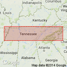
The Jonesboro limestone is restricted to the Ordovician part of the Knox group. On the geologic map of TN, the Knox group is divided into the Conococheague limestone in the lower part and the Jonesboro limestone in the upper part. The Jonesboro consists largely of dark blue weathering limestone, some of which is ribboned, with thin layers of silty dolomite; fairly thick sandstone beds occur in the lower 400 feet or so. Unit is about 2000 feet thick.
Source: GNU records (USGS DDS-6; Reston GNULEX).
- Usage in publication:
-
- Jonesboro Limestone*
- Modifications:
-
- Overview
- AAPG geologic province:
-
- Piedmont-Blue Ridge province
Summary:
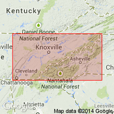
The Jonesboro Limestone of the Knox Group crops out in structural windows of the Great Smoky Mountains in eastern Tennessee. The name Jonesboro Limestone is used in the eastern belts of Tennessee where the subdivisions of the Lower Ordovician cannot be recognized. Unit consists of light- to medium-gray fine-grained to aphanitic limestone, massive gray fine-grained and fossiliferous limestone, dark-gray limestone with dolomite seams, platy limestone which contains rounded quartz grains, sandy limestone, and pink brecciated limestone.
Source: GNU records (USGS DDS-6; Reston GNULEX).
- Usage in publication:
-
- Jonesboro Limestone*
- Modifications:
-
- Biostratigraphic dating
- AAPG geologic province:
-
- Piedmont-Blue Ridge province
Summary:
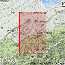
Conodont biostratigraphy of the Jonesboro Limestone in the Calderwood window of the Great Smoky Mountains in eastern TN demonstrate that these rocks are of earliest Ordovician age. The presence of the CORDYLODUS PROAVUS to the ROSSODUS MANITOUENSIS Zones indicate that these rocks correlate with the Chepultepec Dolomite and possibly the upper part of the Conococheague Limestone of the Valley and Ridge province.
Source: GNU records (USGS DDS-6; Reston GNULEX).
For more information, please contact Nancy Stamm, Geologic Names Committee Secretary.
Asterisk (*) indicates published by U.S. Geological Survey authors.
"No current usage" (†) implies that a name has been abandoned or has fallen into disuse. Former usage and, if known, replacement name given in parentheses ( ).
Slash (/) indicates name conflicts with nomenclatural guidelines (CSN, 1933; ACSN, 1961, 1970; NACSN, 1983, 2005, 2021). May be explained within brackets ([ ]).