

- Usage in publication:
-
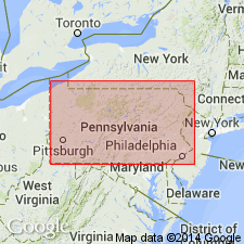
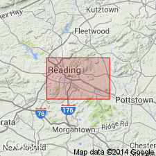
- Jacksonwald trap
- Modifications:
-
- First used
- Dominant lithology:
-
- Trap
- AAPG geologic province:
-
- Piedmont-Blue Ridge province
Summary:
The northern and inner of two concentric trap sheets south of Jacksonwald, Berks Co., PA, differs from the southern intrusive trap dyke. Its extrusive origin is shown by the conformable contact of the base with the underlying shale which is unmetamorphosed, and its compact, fine grained, glassy texture below, gradually becoming coarser and vesicular above. It is inferred that the upper sheet at Jacksonwald represents a small portion of the same magma that formed the intrusive sheet which has found its way to the surface, and is apparently the only extrusive trap east of the Susquehanna River in PA. Thickness is 800 ft (270 m).
Source: GNU records (USGS DDS-6; Reston GNULEX).
- Usage in publication:
-
- Jacksonwald Basalt Member
- Modifications:
-
- Named
- Dominant lithology:
-
- Basalt
- AAPG geologic province:
-
- Newark basin
Summary:
The Jacksonwald trap of Wherry (1910), is here named the Jacksonwald Basalt Member of the Brunswick Formation. It consists of dark-gray, fine-grained basalt with a vesicular top and is chemically identical to York Haven-type intrusives. Overlies the lower member and underlies the upper member of the Brunswick in the Birdsboro quadrangle. It may be too thick to be a single flow unit, but no internal divisions have been identified. Thickness is 500 ft (150 m). Age is Early Jurassic.
Source: GNU records (USGS DDS-6; Reston GNULEX).
- Usage in publication:
-
- Jacksonwald Basalt*
- Modifications:
-
- Revised
- AAPG geologic province:
-
- Newark basin
Summary:
The Jacksonwald trap of Wherry (1910) is here assigned to the revised Brunswick Group as the Jacksonwald Basalt. It correlates with the Orange Mountain Basalt in NJ, and may be part of the same flow. It overlies sedimentary strata of the lower part of the Brunswick Group and underlies strata of the upper part of the Brunswick Group. Age is Early Jurassic.
Source: GNU records (USGS DDS-6; Reston GNULEX).
For more information, please contact Nancy Stamm, Geologic Names Committee Secretary.
Asterisk (*) indicates published by U.S. Geological Survey authors.
"No current usage" (†) implies that a name has been abandoned or has fallen into disuse. Former usage and, if known, replacement name given in parentheses ( ).
Slash (/) indicates name conflicts with nomenclatural guidelines (CSN, 1933; ACSN, 1961, 1970; NACSN, 1983, 2005, 2021). May be explained within brackets ([ ]).