

- Usage in publication:
-
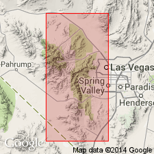
- Indian Springs member
- Modifications:
-
- Named
- Biostratigraphic dating
- Dominant lithology:
-
- Shale
- AAPG geologic province:
-
- Great Basin province
Summary:
Indian Springs member of Bird Springs formation named [not adopted due to preoccupation of name] for exposures near Indian Springs, Clark Co., NV. Consists of yellow, orange, and reddish shales interbedded with limestones and subordinate sandstones. Unit is 700 ft thick. Age is Late Mississippian on the basis of fossils identified by G.H. Girty.
Source: GNU records (USGS DDS-6; Menlo GNULEX).
- Usage in publication:
-
- Indian Springs Formation
- Modifications:
-
- Revised
- Biostratigraphic dating
- AAPG geologic province:
-
- Great Basin province
Summary:
Indian Springs Member of Longwell and Dunbar (1936) is elevated to Indian Springs Formation of Bird Spring Group. Rocks of member were called Illipah Formation by Bissell (1960); however name Indian Springs take precedence over "Illipah". Age is Late Mississippian on the basis of fossils.
Source: GNU records (USGS DDS-6; Menlo GNULEX).
- Usage in publication:
-
- Indian Springs Formation
- Modifications:
-
- Revised
- Overview
- AAPG geologic province:
-
- Great Basin province
Summary:
Indian Springs Member, as originally defined, included the lowest 700 ft of the Bird Spring Formation and was believed to be of formational rank (Longwell and Dunbar, 1936), lying between the Monte Cristo Limestone below and the FUSULINELLA Zone above. The member was thought to be, at least in part, of Chesterian age, as indicated by a study of megafossils by Girty. Langenheim and Langenheim (1965) advocate abandoning the name Indian Springs because it is preoccupied by the Indian Spring Sandstone (Silurian) of MD and Indian Springs Shale (Chesterian) of IN. We judge the MD usage to be distant enough, both geographically and temporally, for no confusion to result from retention of the name in NA, and the unit name in IN has been officially abandoned by the Indiana Geological Survey. There we are retaining the name Indian Springs, as it is the earliest appropriate name for this rock unit in southern NV. The Indian Springs is here removed from the Bird Spring Formation, raised to formational rank, and restricted to red-weathering thin-bedded shale, sandstone, and limestone exposed in a persistent strike valley throughout the area of development. Lithologically the Indian Springs is dominantly black shale that is mostly covered, with locally exposed red and green shales, thin bioclastic limestones, and clean orthoquartzites in the lower two-thirds, grading upward into red-weathering ferruginous limestones with subordinate shale, orthoquartzites, and conglomerates. The lower boundary is the top of the Battleship Wash or Chainman Formation, or, where these are absent, the Monte Cristo Limestone. The upper boundary is marked by the lowest gray-weathering, thick bedded limestones of the Bird Spring Formation. A persistent limestone that includes dark, red-weathering, ferruginous chert-pebble conglomerate in the upper part is present just below the middle of the formation at all outcrops north of Las Vegas Valley as far as Kane Springs Wash. This bed is here referred to as the "marker" conglomerate, and, in the Apex section, it is directly overlain by a bed containing cephalopods that are judged to be of Late Mississippian age. In the type area of the Indian Springs the marker conglomerate has not been found and exact placement of the Mississippian-Pennsylvanian boundary must remain uncertain until the conodonts have been studied. One specimen of CRAVENOCERAS was found in the lower 20 ft of the type Indian Springs, and the lowest foot of the Bird Spring Formation has yielded a well-preserved late Morrowan conodont and cephalopod fauna that includes GASTRIOCERAS cf. G. FITTSI Miller and Owen, BISATOCERAS, GORDONITES, POLYGNATHODELLA, and IDIOGNATHODUS. Consequently the systematic boundary clearly lies within the type section of the Indian Springs Formation. Conodonts associated with these goniatites indicate that the basal Bird Spring Formation in the type Indian Springs area is equivalent to beds at least 320 ft above the base of the Bird Spring in Arrow Canyon. Consequently, to the north, a paraconformity between these two formations at Indian Springs either is absent or represents a considerably shorter time span. Substitution of the name Illipah Formation for the Indian Springs in southern NV (Bissell, 1962) is rejected because the lithologies of the two formations are quite different and the Illipah has been considered a synonym of the Scotty Wash Quartzite (Steele, 1960), with which we concur. Langenheim and others (1962) suggest that their units "BSa" and "BSb" are equivalent to the Indian Springs but do not use the latter term. Their "BSb" is equivalent to the Indian Springs as restricted here and their "BSa" unit has since been named the Battleship Wash Formation.
Source: GNU records (USGS DDS-6; Menlo GNULEX).
- Usage in publication:
-
- Indian Springs Formation*
- Modifications:
-
- Adopted
- AAPG geologic province:
-
- Great Basin province
Summary:
Indian Springs Formation of Webster and Lane (1967) is adopted. Consists of limestone with thin interbeds of siltstone; shale intervals are common in the lower part of the formation. Is exposed only in the west-central part of the quad in the southern Delamar Mountains. Overlain [conformably] by the Bird Spring Formation; lower contact with the Chainman Shale is not exposed. Thickness is estimated at 95 m. Age is given as Late Mississippian. [Adopted by Tony Bryant, DGNU 3/24/93]
Source: GNU records (USGS DDS-6; Menlo GNULEX).
For more information, please contact Nancy Stamm, Geologic Names Committee Secretary.
Asterisk (*) indicates published by U.S. Geological Survey authors.
"No current usage" (†) implies that a name has been abandoned or has fallen into disuse. Former usage and, if known, replacement name given in parentheses ( ).
Slash (/) indicates name conflicts with nomenclatural guidelines (CSN, 1933; ACSN, 1961, 1970; NACSN, 1983, 2005, 2021). May be explained within brackets ([ ]).