


- Usage in publication:
-
- Hordes Creek bed
- Modifications:
-
- Original reference
- Dominant lithology:
-
- Limestone
- AAPG geologic province:
-
- Bend arch
Summary:
Pg. 421, 422. Hordes Creek bed in Albany division Impure limestones, 10 to 30 feet thick, with some layers of sandstone and clay. Member of Albany division [Albany is uppermost of 5 Carboniferous divisions of Cummins, 1891]. Overlies Lost Creek bed and underlies Indian Creek bed. Age is possibly Permian.
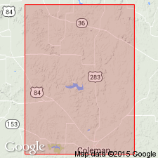
[Named from Hordes Creek, Coleman Co., Colorado River region, central TX.]
Source: Publication; US geologic names lexicon (USGS Bull. 896, p. 980).

- Usage in publication:
-
- Hordes Creek limestone lentil
- Modifications:
-
- Revised
- AAPG geologic province:
-
- Bend arch
Summary:
Pg. 192, 193, and charts. Hordes Creek limestone lentil is in lower part of Admiral formation (basal formation of Wichita group). Overlies Lost Creek shale member and underlies Indian Creek shale member. [Age is Permian.]
Source: US geologic names lexicon (USGS Bull. 896, p. 980).

- Usage in publication:
-
- Hords Creek formation
- Modifications:
-
- Revised
- AAPG geologic province:
-
- Bend arch
Summary:
Pg. 66 (fig. 1). Hords Creek formation. Rank raised to formation in Admiral herein restricted and given group status. Underlies Fisk formation (new); overlies Coleman Junction formation in Putnam group. [Age is Permian (Wolfcamp).]
Source: US geologic names lexicon (USGS Bull. 1200, p. 1803).
- Usage in publication:
-
- Hords Creek limestone
- Modifications:
-
- Areal extent
- AAPG geologic province:
-
- Bend arch
Summary:
Pg. 1 (footnote by R.C. Moore). Hords Creek limestone underlies Wildcat Creek shale member (new) of Admiral formation. [Age is Early Permian (Wolfcamp).]
Source: US geologic names lexicon, USGS Bull. 1200, p. 1803).

- Usage in publication:
-
- Hords Creek limestone member
- Modifications:
-
- Areal extent
- AAPG geologic province:
-
- Bend arch
Summary:
Sheet 2. Hords Creek limestone member of Admiral formation. Columnar section shows Hords Creek limestone member underlying Wildcat Creek shale member and overlying Lost Creek shale member of Admiral formation. Age is Early Permian (Wolfcamp).
Source: Publication; US geologic names lexicon (USGS Bull. 1200, p. 1803).

- Usage in publication:
-
- Hords Creek Limestone
- Modifications:
-
- Areal extent
- AAPG geologic province:
-
- Bend arch
Summary:
Shown as a unit [unranked] in the lower part of Admiral Formation, at top of Coleman Junction Formation (both of Albany Group), and separately mapped. Present in south-central Throckmorton Co, in north-central TX on Bend arch. Northern termination is west of Woodson. Thickness is 1-2 ft, and thins northward. Is a gray and yellow, fine-grained limestone, in part intraclastic; erodes to small slabs and blocks. Age is Wolfcamp (Early Permian). Geologic map.
Source: GNU records (USGS DDS-6; Denver GNULEX).
For more information, please contact Nancy Stamm, Geologic Names Committee Secretary.
Asterisk (*) indicates published by U.S. Geological Survey authors.
"No current usage" (†) implies that a name has been abandoned or has fallen into disuse. Former usage and, if known, replacement name given in parentheses ( ).
Slash (/) indicates name conflicts with nomenclatural guidelines (CSN, 1933; ACSN, 1961, 1970; NACSN, 1983, 2005, 2021). May be explained within brackets ([ ]).