

- Usage in publication:
-
- Hondo sandstone member
- Modifications:
-
- Original reference
- Dominant lithology:
-
- Sandstone
- AAPG geologic province:
-
- Orogrande basin
- Permian basin
Summary:
Hondo sandstone member of Chupadera formation. Chupadera formation of Pecos Valley region here divided into (descending): (1) San Andres limestone member (replaces Picacho limestone of Fiedler and Nye); (2) Hondo sandstone member, and (3) Yeso member. The Hondo sandstone consists of coarse white quartz grains, variably streaked yellowish to brownish red and cemented by iron and lime. In places it is cross-bedded, and iron concretions and nodules are abundant in upper part. Thickness usually 50+/- feet. Has been commonly referred to in the field as "Glorieta sandstone," but it has never been definitely shown that this sandstone is wholly or in part the sandstone of Glorieta Mesa. Of great value in subsurface correlation. Age is Permian. [The adoption of Hondo sandstone member involves a slight redefinition of both San Andres limestone and Yeso as originally defined and heretofore used.]
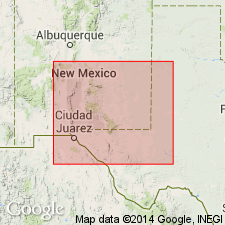
Crops out near bottom of valley of Hondo River and its tributaries, [near Roswell], Pecos Valley region, southeastern NM.
Source: US geologic names lexicon (USGS Bull. 896, p. 975).
- Usage in publication:
-
- Hondo sandstone member*
- Modifications:
-
- Revised
- AAPG geologic province:
-
- Orogrande basin
Summary:
Pg. 542 (fig. 2), 687, pl. 2. Hondo sandstone reallocated to member status in San Andres herein rank raised to formation. Term Chupadera abandoned. Age is Early Permian (Leonard).
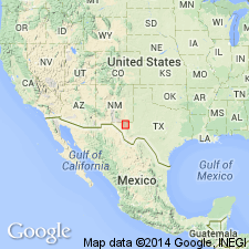
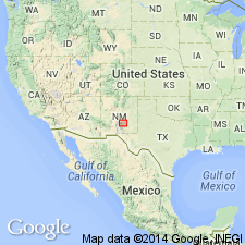
Recognized in Sacramento Mountains, Otero Co., NM.
Source: US geologic names lexicon (USGS Bull. 1200, p. 1795); supplemental information from GNU records (USGS DDS-6; Denver GNULEX).
- Usage in publication:
-
- Hondo Sandstone Member*
- Modifications:
-
- Areal extent
- AAPG geologic province:
-
- Orogrande basin
Summary:
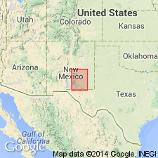
The Permian Hondo Sandstone Member of the San Andres Limestone and the Glorieta Sandstone beneath the San Andres in Otero, Lincoln, and Socorro Cos., Orogrande basin, NM have been thought to be identical units. Both are even bedded, have small scale cross laminations, and are gray. The Hondo has clear quartz, sparse rose quartz, smoky quartz, and is slightly coarser grained than the Glorieta. Both are present between Lone Mountain in sec. 22, T 6 S, R 11 E and Riverside in sec. 21, T 11 S, R 19 E on Rio Hondo. Cross sections. Block diagrams. The two sandstones are recognized in this report as two different units separated by an unnamed limestone of the San Andres. Hondo, the younger sandstone, overlies the unnamed limestone, and Glorieta underlies the unnamed limestone. The two sandstones may merge to the north but no proof exists. Hondo thickens toward southeast NM whereas Glorieta wedges out to the southeast. In many areas, only one sandstone is present. The unnamed limestone thins northward. Glorieta and San Andres were deposited in a marine environment.
Source: GNU records (USGS DDS-6; Denver GNULEX).
- Usage in publication:
-
- Hondo Sandstone Member
- Modifications:
-
- Not used
Summary:
Regional mapping has shown that Hondo Sandstone Member of the San Andres Limestone is indistinguishable from the Glorieta Sandstone. Lang's (1937) Hondo is just a tongue of the Glorieta. Author recommends term Hondo be dropped.
Source: GNU records (USGS DDS-6; Denver GNULEX).
For more information, please contact Nancy Stamm, Geologic Names Committee Secretary.
Asterisk (*) indicates published by U.S. Geological Survey authors.
"No current usage" (†) implies that a name has been abandoned or has fallen into disuse. Former usage and, if known, replacement name given in parentheses ( ).
Slash (/) indicates name conflicts with nomenclatural guidelines (CSN, 1933; ACSN, 1961, 1970; NACSN, 1983, 2005, 2021). May be explained within brackets ([ ]).