

- Usage in publication:
-
- Hines Quartz Diorite*
- Modifications:
-
- Named
- Geochronologic dating
- Dominant lithology:
-
- Quartz diorite
- AAPG geologic province:
-
- Wisconsin arch
Summary:
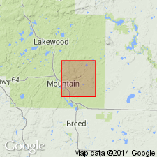
First described in Lahr thesis (1957). Named in this report for relatively undeformed intrusive rocks exposed near Hines Creek, just east of Mountain in north-central Oconto Co, WI, in Lake Superior region. Type area designated in southern part of sec. 12, T31N, R16E. Is dark-gray, massive, medium-grained quartz diorite confined to shear zone shown on accompanying geologic map. Is variably altered, containing plagioclase and primary mafic minerals now altered to amphibole, sparse biotite, opaque oxides, and locally, to chlorite. Has a U-Pb zircon intercept age of 1812.7+-3.6 Ma (Early Proterozoic) and was emplaced within shear zone at or near end of regional ductile deformation. Intrudes Waupee Volcanics. Is separated by shear zone from younger Middle Proterozoic intrusive rocks of Wolf River batholith.
Source: GNU records (USGS DDS-6; Reston GNULEX).
For more information, please contact Nancy Stamm, Geologic Names Committee Secretary.
Asterisk (*) indicates published by U.S. Geological Survey authors.
"No current usage" (†) implies that a name has been abandoned or has fallen into disuse. Former usage and, if known, replacement name given in parentheses ( ).
Slash (/) indicates name conflicts with nomenclatural guidelines (CSN, 1933; ACSN, 1961, 1970; NACSN, 1983, 2005, 2021). May be explained within brackets ([ ]).