

- Usage in publication:
-
- Hidden Valley dolomite*
- Modifications:
-
- Original reference
- Dominant lithology:
-
- Dolomite
- AAPG geologic province:
-
- Great Basin province
Summary:
p. 3, 14 (fig. 6), 15, pl. 1, 2, 3. Hidden Valley dolomite. Uniformly consists of dolomite but contains nodular chert near base and a little silt and sand near top. In lowest and highest units dolomite is medium gray and weathers light olive gray and yellowish gray; middle is light gray or creamy; chert is light gray or light brown and weathers to dark brown; contains silicifled fossils. Thickness 1,365 feet at type locality and in Andy Hills. Underlies Devonian Lost Burro formation (new); overlies Ely Springs dolomite. Lower fossiliferous part of Hidden Valley is Silurian; near upper boundary of formation is a 50-foot zone containing Lower Devonian fossils. Thus Silurian-Devonian boundary falls within uppermost part of the Hidden Valley; the persistent lithologic change is above the Lower Devonian fossils, and this distinctive formational boundary has been mapped over a broad area.
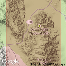
Type locality: on eastern flank of mountain about 2.5 mi north of Ubehebe Peak, and about 0.75 mi west of the road in Racetrack Valley. Named from good exposure on eastern side of Hidden Valley, about 3 mi east-southeast from bench mark 5980 near Lost Burro Gap, northern Panamint Range, Inyo Co., southern CA.
Source: US geologic names lexicon (USGS Bull. 1200, p. 1754).
- Usage in publication:
-
- Hidden Valley dolomite*
- Modifications:
-
- Revised
- AAPG geologic province:
-
- Great Basin province
Summary:
Pg. 9 (fig. 3), 12, pl. 2. Hidden Valley dolomite. In Ubehebe Peak quadrangle, underlies Lippincott member (new) of Lost Burro formation.
Source: US geologic names lexicon (USGS Bull. 1200, p. 1754).
For more information, please contact Nancy Stamm, Geologic Names Committee Secretary.
Asterisk (*) indicates published by U.S. Geological Survey authors.
"No current usage" (†) implies that a name has been abandoned or has fallen into disuse. Former usage and, if known, replacement name given in parentheses ( ).
Slash (/) indicates name conflicts with nomenclatural guidelines (CSN, 1933; ACSN, 1961, 1970; NACSN, 1983, 2005, 2021). May be explained within brackets ([ ]).