

- Usage in publication:
-
- Hemlock Conglomerate, Formation
- Modifications:
-
- Named
- Dominant lithology:
-
- Sandstone
- Conglomerate
- AAPG geologic province:
-
- Alaska Southern region
Summary:
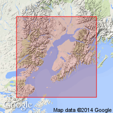
Named as fourth from top of five units of Kenai Group. Type section designated as subsurface exposures in Richfield Oil Corporation Swanson River Unit No. 1 well, sec. 10 T8N R9W, Cook Inlet Basin, AK. Previously called Hemlock oil zone (Parkinson, 1962; Hill, 1963). Composed of thick sequence of gray to brown conglomeratic sandstone and conglomerate. Is 170 m thick. Unconformably overlies West Foreland Formation (new). Underlies Tyonek Formation. Age is Tertiary.
Source: GNU records (USGS DDS-6; Menlo GNULEX).
- Usage in publication:
-
- Hemlock Conglomerate
- Modifications:
-
- Age modified
- AAPG geologic province:
-
- Alaska Southern region
Summary:
Characterized by quartz-chert conglomerate and quartzitic, garnetiferous sandstone. Underlies Tyonek Formation; overlies West Foreland Formation. Correlation chart shows age as Miocene. [no basis given].
Source: GNU records (USGS DDS-6; Menlo GNULEX).
- Usage in publication:
-
- Hemlock Conglomerate*
- Modifications:
-
- Adopted
- AAPG geologic province:
-
- Alaska Southern region
Summary:
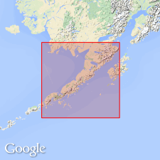
Hemlock Conglomerate of Calderwood and Fackler (1972) adopted. In Cook Inlet basin to southeast, Hemlock Conglomerate overlies West Foreland Formation. At exposures near Capps Glacier, Hemlock is missing because of erosion or nondeposition, this conclusion based on palynological determinations of K.R. Newman (Colorado School of Mines). Hemlock Conglomerate is important oil reservoir.
Source: GNU records (USGS DDS-6; Menlo GNULEX).
- Usage in publication:
-
- Hemlock Sandstone Member
- Modifications:
-
- Revised
- AAPG geologic province:
-
- Alaska Southern region
Summary:
Hemlock Conglomerate of Calderwood and Fackler (1972) is reduced in rank to Hemlock Sandstone Member of Tyonek Formation, due to similarities with gradationally overlying sandstones of Tyonek Formation.
Source: GNU records (USGS DDS-6; Menlo GNULEX).
- Usage in publication:
-
- Hemlock Conglomerate*
- Modifications:
-
- Age modified
- AAPG geologic province:
-
- Alaska Southern region
Summary:
Mapped undivided with Tyonek Formation, Cook Inlet area, AK. Correlation chart shows age of Hemlock Conglomerate as late Oligocene (Angoonian Floral Stage) in Copper Lake-Cape Douglas and East Glacier Creek-Homer areas. Underlies Tyonek Formation. Unconformably overlies West Foreland Formation which is excluded from Kenai Group on correlation chart.
Source: GNU records (USGS DDS-6; Menlo GNULEX).
- Usage in publication:
-
- Hemlock Conglomerate*
- Modifications:
-
- Age modified
- AAPG geologic province:
-
- Alaska Southern region
Summary:
Recognized as oldest formation (of 4) of Kenai Group. Underlies Tyonek Formation (Kenai Group). Age is early Oligocene.
Source: GNU records (USGS DDS-6; Menlo GNULEX).
- Usage in publication:
-
- Hemlock Conglomerate*
- Modifications:
-
- Areal extent
- AAPG geologic province:
-
- Alaska Peninsula province
- Alaska Southwestern region
Summary:
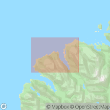
Hemlock Conglomerate. Unit geographically extended into area bounding Shelikof Strait; extends from about Lat. 59 deg. W. south to Katmai Bay. Age is late Oligocene on the basis of plant fossils (J.A. Wolfe, written commun., 1991) [USGS Preliminary Report on Referred Fossils].
Source: Modified from GNU records (USGS DDS-6; Menlo GNULEX).
For more information, please contact Nancy Stamm, Geologic Names Committee Secretary.
Asterisk (*) indicates published by U.S. Geological Survey authors.
"No current usage" (†) implies that a name has been abandoned or has fallen into disuse. Former usage and, if known, replacement name given in parentheses ( ).
Slash (/) indicates name conflicts with nomenclatural guidelines (CSN, 1933; ACSN, 1961, 1970; NACSN, 1983, 2005, 2021). May be explained within brackets ([ ]).