

- Usage in publication:
-
- Harpole Mesa formation*
- Modifications:
-
- Named
- Dominant lithology:
-
- Till
- Gravel
- Sand
- Silt
- AAPG geologic province:
-
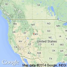
- Paradox basin
Summary:
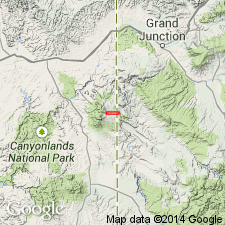
Named for Harpole Mesa, UT. Type section measured on south side of Spring Draw in SW1/4 SW1/4 sec 32, T25S, R24E, Grand Co in Paradox basin. At type is 108 ft thick, is divisible into lower, middle, and upper members, and overlies unconformably Pliocene? or Pleistocene? conglomerate. Is older than Placer Creek Formation (new). The three members not found in superposition except on Harpole Mesa. Lower member has alluvial gravel, till, and eolian sand and silt facies. Middle member has till and alluvial gravel facies. Upper member has till, alluvial gravel, alluvial-fan gravel, talus, frost rubble, and solifluction mantle facies. Volcanic ash present on south side Onion Creek, NW1/4 NW1/4 sec 23, T24S, R24E, thought to be similar to Pearlette ash of Great Plains. Of Pleistocene age.
Source: GNU records (USGS DDS-6; Denver GNULEX).
- Usage in publication:
-
- Harpole Mesa Formation*
- Modifications:
-
- Revised
- AAPG geologic province:
-
- Paradox basin
Summary:
Overlies the newly named Geyser Creek Fanglomerate in Grand and San Juan Cos, UT in the Paradox basin.
Source: GNU records (USGS DDS-6; Denver GNULEX).
- Usage in publication:
-
- Harpole Mesa Formation*
- Modifications:
-
- Geochronologic dating
- Areal extent
- AAPG geologic province:
-
- Paradox basin
Summary:
An ash at the Cudahy ash mine in Meade Co, KS is petrologically and chemically similar to an ash in Harpole Mesa Formation at SE1/4 NE1/4 sec 26, T24S, R24E, Grand Co, UT in the Paradox basin. Ash in UT believed to be 0.6 +/-0.07 m.y. or the downwind equivalent of the Lava Creek Tuff, or of the Pearlette type O family of ash beds.
Source: GNU records (USGS DDS-6; Denver GNULEX).
For more information, please contact Nancy Stamm, Geologic Names Committee Secretary.
Asterisk (*) indicates published by U.S. Geological Survey authors.
"No current usage" (†) implies that a name has been abandoned or has fallen into disuse. Former usage and, if known, replacement name given in parentheses ( ).
Slash (/) indicates name conflicts with nomenclatural guidelines (CSN, 1933; ACSN, 1961, 1970; NACSN, 1983, 2005, 2021). May be explained within brackets ([ ]).