

- Usage in publication:
-
- Harkless Formation*
- Modifications:
-
- Original reference
- Dominant lithology:
-
- Shale
- Sandstone
- Siltstone
- AAPG geologic province:
-
- Great Basin province
Summary:
Pg. 140 (fig. 2), 142, 143. Harkless Formation. Over much of area especially from type section northward and northwestward the Harkless is predominantly gray-green shale and thin-bedded to platy fine-grained quartzitic sandstone and siltstone. From type section southward to Waucoba Spring area formation contains massive vitreous quartzite (carries SCOLITHUS [SKOLITHOS]) interbedded in shale and quartzite becomes dominant. Locally contains thin beds of pisolitic limestone and archaeocyathid limestone in basal portion. Thickness 2,000 feet. Overlies Poleta Formation (new); underlies Saline Valley Formation (new). Age is Early Cambrian.
Term Harkless sandstone was first used by Resser and Bridge (IN Reeside, 1933, 16th Intl. Geol. Cong. U.S. Gdbk., no. 29, pl. 1) and labeled Middle Cambrian. It appears that they included essentially what is here called Harkless except for its basal part, and that they followed Kirk (IN Adolph Knopf, 1918, USGS Prof. Paper 110) who believed the beds to be Middle Cambrian. Harkless sandstone of Resser and Bridge was not described and its upper and lower limits not specified; it is not a valid formation.
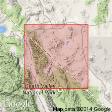
Named from exposures on divide south of Harkless Flat in southern half of Waucoba Mountain 15-min quadrangle, Inyo Mountains, Inyo Co., central eastern CA.
[See also C.A. Nelson, 1966a, Geol. map Waucoba Mountain quadrangle, CA, USGS Geol. Quad. Map GQ-528, 1 sheet, scale 1:62,500; C.A. Nelson, 1966b, Geol. map Blanco Mountain quadrangle, CA, USGS Geol. Quad. Map GQ-529, 1 sheet, scale 1:62,500.]
Source: US geologic names lexicon (USGS Bull. 1350, p. 320-321).
For more information, please contact Nancy Stamm, Geologic Names Committee Secretary.
Asterisk (*) indicates published by U.S. Geological Survey authors.
"No current usage" (†) implies that a name has been abandoned or has fallen into disuse. Former usage and, if known, replacement name given in parentheses ( ).
Slash (/) indicates name conflicts with nomenclatural guidelines (CSN, 1933; ACSN, 1961, 1970; NACSN, 1983, 2005, 2021). May be explained within brackets ([ ]).