

- Usage in publication:
-
- Harkers fanglomerate
- Modifications:
-
- Overview
- AAPG geologic province:
-
- Wasatch uplift
Summary:
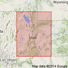
Shown on a correlation chart as a Pliocene and Pleistocene unit of the Traverse and Oquirrh Mountains, UT on Wasatch uplift, that correlates with the Huntsville fanglomerate of the Morgan Valley, and with the Collinston fanglomerate and Cache Valley formation of Cache Valley. Term Salt Lake group not used. Was a deposit that resulted from widespread block faulting that started in early and middle Miocene time and was associated with volcanism. Deposition of fanglomerates ceased in Pleistocene time.
Source: GNU records (USGS DDS-6; Denver GNULEX).
- Usage in publication:
-
- Harkers fanglomerate
- Modifications:
-
- Named
- Dominant lithology:
-
- Conglomerate
- AAPG geologic province:
-
- Wasatch uplift
Summary:
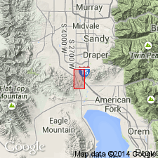
Named as the upper formation of the Salt Lake group for Harkers Canyon and vicinity, northern part of Oquirrh foothills south of Bacchus, Salt Lake Co, UT on the Wasatch uplift. This locality designated the type locality. Outcrops limited. Unit is dominant in foothills. Described as a tan to gray, poorly consolidated except for local lenses, poorly sorted fanglomerate. Torrential bedding and cut-and-fill structures common. Composed of angular to subround quartzite, sandstone, limestone, andesite, latite which range in size from silt to boulders 6 to 8 ft across. Matrix is tuffaceous. Is at least 300 ft thick. Is in fault contact with Camp Williams unit of Salt Lake group or overlies it unconformably. Was a series of coalescing alluvial fans. Assigned to the late early to late Pliocene because 1) has gentle dips; 2) poorly sorted, not well consolidated; 3) lack of geomorphic expression; 4) occurs at higher elevations (6,000 ft) than Pleistocene sediments (5,200 ft). Cross sections. Geologic map.
Source: GNU records (USGS DDS-6; Denver GNULEX).
- Usage in publication:
-
- Harkers Alluvium*
- Modifications:
-
- Redescribed
- Age modified
- Dominant lithology:
-
- Gravel
- Sand
- Silt
- AAPG geologic province:
-
- Wasatch uplift
Summary:
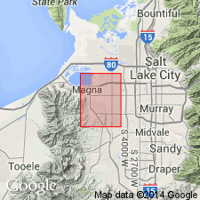
Redescribed from Harkers Fanglomerate to Harkers Alluvium. [Not shown as part of Salt Lake Group.] Described as a partly dissected alluvial fan consisting of unconsolidated, poorly sorted boulders, coarse to fine gravel, sand and silt. Occurs in Coon and Harkers Canyons, both in mountains and in adjoining Jordan Valley. Rank term modified because of its great size distribution and unindurated nature. Thickness variable and unknown. In Coon Creek, Harkers has been incised 150 ft. Estimated to be 150 to 250 ft thick. Unconformably overlies Tertiary rocks. Unconformably underlies Lake Bonneville Group. Age considered to be Pleistocene rather than Pliocene as was thought by Slentz (1955), and probably early Pleistocene because it is unconsolidated and because it overlies consolidated Tertiary sedimentary and volcanic deposits. Report area is on Wasatch uplift.
Source: GNU records (USGS DDS-6; Denver GNULEX).
For more information, please contact Nancy Stamm, Geologic Names Committee Secretary.
Asterisk (*) indicates published by U.S. Geological Survey authors.
"No current usage" (†) implies that a name has been abandoned or has fallen into disuse. Former usage and, if known, replacement name given in parentheses ( ).
Slash (/) indicates name conflicts with nomenclatural guidelines (CSN, 1933; ACSN, 1961, 1970; NACSN, 1983, 2005, 2021). May be explained within brackets ([ ]).