

- Usage in publication:
-
- Hancock limestone*
- Modifications:
-
- Original reference
- Dominant lithology:
-
- Limestone
- AAPG geologic province:
-
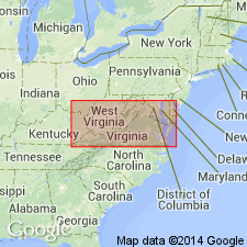
- Appalachian basin
Summary:
Pg. 3. Hancock limestone. Interbedded massive and shaly limestones, of blue, gray, or dove color; massive beds more frequent at bottom and top, and attain thickness of 20 feet. In general appearance strongly resembles Chickamauga limestone. Fossils throughout formation show it to be of Late Silurian age. Thickness 0 to 450 feet. Underlies Chattanooga shale and overlies Rockwood formation.
[Named from Hancock Co., northeastern TN.]
Source: US geologic names lexicon (USGS Bull. 896, p. 905).

- Usage in publication:
-
- Hancock limestone*
- Modifications:
-
- Overview
- AAPG geologic province:
-
- Appalachian basin
Summary:
Hancock limestone. Foregoing [see Keith 1896 USGS Morristown folio (no. 27) entry] is original definition at type locality. The name, however, first appeared in print in 1894, in USGS Estillville folio (no. 12), by M.R. Campbell, who accepted Keith's name, correlating the rocks of Estillville quadrangle with those of Morristown quadrangle. He described the formation as consisting of blue fossiliferous limestone, very sandy at top and bottom, 180 to 275 feet thick, underlying Chattanooga black shale and overlying Rockwood formation.
The beds at type locality are now [ca. 1936] considered to be of Silurian (late Cayugan) age, but the formation as described and mapped in early reports on southwestern Virginia is chiefly of Helderberg age (Early Devonian). At present [ca. 1936] the USGS uses Cayuga limestone for the beds of Silurian age in southwestern Virginia and Helderberg limestone for the beds of Early Devonian age in southwestern Virginia.
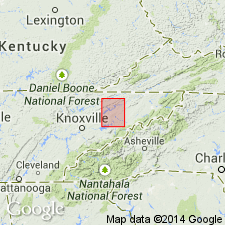
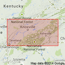
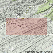
Named from Hancock Co., northeastern TN.
Source: US geologic names lexicon (USGS Bull. 896, p. 905).
- Usage in publication:
-
- Hancock limestone*
- Modifications:
-
- Age modified
- AAPG geologic province:
-
- Appalachian basin
Summary:
Pg. 103. Hancock limestone in eastern Tennessee consists chiefly of fairly thick-bedded limestone and dolomite, many layers being sandy and a few cherty; some layers, especially at base or where formation is thin, contain so much sand as to grade into calcareous or dolomitic sandstone; some sand carries Lower Devonian fossils. May be more than 300 feet thick locally in belt on south side of Powell Mountain, but elsewhere is thinner. Occurs above Rockwood formation. [Age is Late Silurian or Silurian and Devonian.]
Source: US geologic names lexicon (USGS Bull. 1200, p. 1661-1662).
- Usage in publication:
-
- Hancock dolomite*
- Modifications:
-
- Revised
- Redescribed
- AAPG geologic province:
-
- Appalachian basin
Summary:
Although Keith (1896) had named Hancock limestone for limestone and dolomite of Late Silurian age in Morristown quad, the name had been used by Campbell (1894) two years earlier in Estillville quad, which covers an area northeast of Morristown quad and includes part of Jonesville district. However, in Estillville quad, beds of Helderberg age, which are present above Upper Silurian beds, were included in Hancock. More recently, Upper Silurian beds have been called Cayuga limestone, and beds of Helderberg age have been called Helderberg limestone. Because the name Hancock has priority in southwest VA and, as originally defined by Keith, does not cross a systemic boundary, the name should be restored to good standing and restricted, as Keith did, to carbonate beds of Late Silurian age. In Jonesville district, formation is composed almost entirely of dolomite, so it is here called Hancock dolomite. Hancock is identical to Cayuga dolomite as used by Miller and Fuller (1947) in Rose Hill district, and to "formations of Cayugan age" as used by Bates (1939). Disconformably overlies Clinton shale; unconformably overlain by Upper Devonian black shale. Dolomitic beds in Hancock are unfossiliferous; however, limestone in lower part of formation contains a few very characteristic fossils including the corals COENITES sp., FAVOSITES sp., and HALYSITES sp. cf. H. CATENULATUS, and a small stromatoporoid. Fossils do not yield sufficient age information. However, Hancock appears to be exact equivalent of Cayuga limestone of Stose (1923) in Wise Co., VA, where the more limy beds contain fossils. Stose (1923) and Butts (1940) believe Cayuga to be of Wills Creek and Tonoloway age. G.A. Cooper states that fossils from Hancock appear to be of Rochester age, which indicates that it may contain some beds of pre-Cayugan age. Geologic map shows Hancock dolomite as Silurian in age and includes a note that it is the same as Cayuga dolomite as used in Virginia Geological Survey's Bulletin 71. Report contains geologic map, cross sections, correlation charts, measured sections, and fossil lists.
Source: GNU records (USGS DDS-6; Reston GNULEX).
- Usage in publication:
-
- Hancock dolomite
- Modifications:
-
- Areal extent
- AAPG geologic province:
-
- Appalachian basin
Summary:
Cayuga group is mapped undivided and includes Hancock dolomite in southwestern VA.
Source: GNU records (USGS DDS-6; Reston GNULEX).
- Usage in publication:
-
- Hancock Limestone*
- Modifications:
-
- Revised
- AAPG geologic province:
-
- Appalachian basin
Summary:
Hancock Limestone revised by contact with newly named overlying Early and Middle(?) Devonian Wildcat Valley Sandstone.
Source: GNU records (USGS DDS-6; Reston GNULEX).

- Usage in publication:
-
- Hancock Formation
- Modifications:
-
- Revised
- Redescribed
- AAPG geologic province:
-
- Appalachian basin
Summary:
Used as Hancock Formation. Mapped undivided with Rose Hill and Clinch Formations. Grades from dolomite and minor limestone and a basal sandstone in southwestern Lee Co. (Cayuga Dolomite of Miller and Fuller, 1954) to limestone with underlying or interbedded dolomite with sandstone partings and basal sandstone to northeast and east. Equivalent to Tonoloway Limestone of Cayuga Group. [Intent to revise not stated, but redescription of unit's lithologies is implied.]
Source: GNU records (USGS DDS-6; Reston GNULEX).
For more information, please contact Nancy Stamm, Geologic Names Committee Secretary.
Asterisk (*) indicates published by U.S. Geological Survey authors.
"No current usage" (†) implies that a name has been abandoned or has fallen into disuse. Former usage and, if known, replacement name given in parentheses ( ).
Slash (/) indicates name conflicts with nomenclatural guidelines (CSN, 1933; ACSN, 1961, 1970; NACSN, 1983, 2005, 2021). May be explained within brackets ([ ]).