

- Usage in publication:
-
- Hamilton Island Limestone*
- Modifications:
-
- Named
- Biostratigraphic dating
- AAPG geologic province:
-
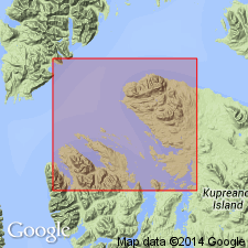
- Alaska Southeastern region
Summary:
[Named after Hamilton Island] Type locality: NW tip of Hamilton Is., 800 ft ESE of triangulation station Beth near NW end of Kupreanof Is. Is very thin-bedded dark-gray aphanitic limestone locally dolomitic. Crops out on Hamilton Is., N side of Hamilton Bay, and NE Keku Islets. Probably several 100 ft thick (unreliable due to complex folding). Conformably overlies Burnt Island Conglomerate; in some areas disconformably overlies Pybus Fm (thin unit of Burnt Island may be present). Conformably overlain by Hound Island Volcanics; on Hamilton Island upper beds of Hamilton Island Ls interbedded with lower beds of Hound Island Volcanics. Similar to argillite member of Hyd Fm. Fossils abundant; mostly HALOBIA; mostly late Karnian; age is Late Triassic. HALOSIA suggests deep-water marine environment. Coeval with shallow water Cornwallis Ls and part of Hound Island Volcanics (also of Hyd Group).
Source: GNU records (USGS DDS-6; Menlo GNULEX).
For more information, please contact Nancy Stamm, Geologic Names Committee Secretary.
Asterisk (*) indicates published by U.S. Geological Survey authors.
"No current usage" (†) implies that a name has been abandoned or has fallen into disuse. Former usage and, if known, replacement name given in parentheses ( ).
Slash (/) indicates name conflicts with nomenclatural guidelines (CSN, 1933; ACSN, 1961, 1970; NACSN, 1983, 2005, 2021). May be explained within brackets ([ ]).