

- Usage in publication:
-
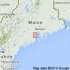
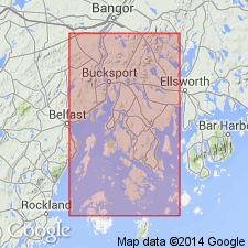
- Gushee Member
- Modifications:
-
- Named
- Dominant lithology:
-
- Amphibolite
- Schist
- AAPG geologic province:
-
- New England province
Summary:
Gushee Member of the Penobscot Formation named for Roland Gushee farm, Belfast quad., Waldo Co., ME. Consists of rusty or chalky weathering, coarse- to fine-grained, sulfidic anthophyllite-cordierite rock, amphibolite, quartz-albite granofels, and minor mica schist. Amphibolite contains relict scoria and pillows. Thickness is 500 meters. Occurs near contact of Penobscot with overlying Appleton Ridge Formation of Bickel (1976) along St. George fault. Age is Ordovician(?).
Source: GNU records (USGS DDS-6; Reston GNULEX).
- Usage in publication:
-
- Gushee Member*
- Modifications:
-
- Overview
- AAPG geologic province:
-
- New England province
Summary:
The Gushee Member of the Penobscot Formation in northern Penobscot Bay, ME consists of biotite-bearing amphibolite beds that occur in the lower portion of the Penobscot. Unit is dark greenish gray, medium- to fine-grained rock with calcite veinlets, locally. Interpreted as metamorphosed basalts that were erupted as intraplate tholeiites. The Gushee is of Ordovician age.
Source: GNU records (USGS DDS-6; Reston GNULEX).
For more information, please contact Nancy Stamm, Geologic Names Committee Secretary.
Asterisk (*) indicates published by U.S. Geological Survey authors.
"No current usage" (†) implies that a name has been abandoned or has fallen into disuse. Former usage and, if known, replacement name given in parentheses ( ).
Slash (/) indicates name conflicts with nomenclatural guidelines (CSN, 1933; ACSN, 1961, 1970; NACSN, 1983, 2005, 2021). May be explained within brackets ([ ]).