

- Usage in publication:
-
- Gunsight Pass Member*
- Modifications:
-
- Named
- Dominant lithology:
-
- Sandstone
- Shale
- AAPG geologic province:
-
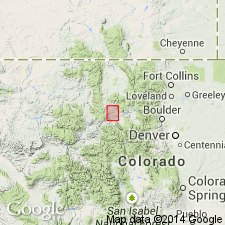
- North Park basin
Summary:
Named for Gunsight Pass in Grand Co as a member at top of middle part of Pierre Shale in North Park basin of north-central CO. Type locality is in the northwestern part of T3N, R80W. Is 150 to 170 ft thick. Divided into: 1) lower part is a 10 to 20 ft thick, very fine-grained sandstone that has a zone of brown-weathering calcareous sandstone concretions about 3 ft in diameter; 2) middle part is about 100 ft thick and is a silty shale that contains gray calcareous siltstone concretions about 1 ft in diameter; 3) upper part is cliff-forming sandstone as much as 50 ft thick. Basal contact with an unnamed part of Pierre is gradational over several ft; upper contact with dark-gray shale of an unnamed part of the Pierre is very sharp. Is in Range Zone of BACULITES JENSENI or BACULITES ELIASI of late Campanian or Late Cretaceous age.
Source: GNU records (USGS DDS-6; Denver GNULEX).
For more information, please contact Nancy Stamm, Geologic Names Committee Secretary.
Asterisk (*) indicates published by U.S. Geological Survey authors.
"No current usage" (†) implies that a name has been abandoned or has fallen into disuse. Former usage and, if known, replacement name given in parentheses ( ).
Slash (/) indicates name conflicts with nomenclatural guidelines (CSN, 1933; ACSN, 1961, 1970; NACSN, 1983, 2005, 2021). May be explained within brackets ([ ]).