- Usage in publication:
-
- Guilford granite
- Modifications:
-
- Named
- Dominant lithology:
-
- Granite
- AAPG geologic province:
-
- Piedmont-Blue Ridge province
Summary:
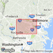
Named the Guilford granite in central MD for structureless, biotite-muscovite granite with associated pegmatite. Unit named on map legend with units older than Glenarm series. Age of the Guilford is unknown.
Source: GNU records (USGS DDS-6; Reston GNULEX).

- Usage in publication:
-
- Guilford Quartz Monzonite
- Modifications:
-
- Revised
- Areal extent
- AAPG geologic province:
-
- Piedmont-Blue Ridge province
Summary:
Guilford Quartz Monzonite, as it is referred to in this report, crops out east of Clarksville gneiss dome near Guilford, Atholton, Simpsonville, and Oakland Mills. Occurs in numerous east- to northeast-trending lenticular bodies, several yards to 3 mi long. Wissahickon Formation is principal wall rock, but southernmost mass penetrates Baltimore Gabbro and Laurel Formation. Plutons are discordant, cutting across bedding and schistosity of the Wissahickon. Near Guilford, truncates Laurel Formation and penetrates Baltimore Gabbro as narrow wedge nearly 2 mi long.
Source: GNU records (USGS DDS-6; Reston GNULEX).

- Usage in publication:
-
- Guilford Quartz Monzonite
- Modifications:
-
- Geochronologic dating
- AAPG geologic province:
-
- Piedmont-Blue Ridge province
Summary:
Isotopic dating (Rb-Sr) of the Guilford Quartz Monzonite indicates that the unit is of Silurian age (425 Ma).
Source: GNU records (USGS DDS-6; Reston GNULEX).

- Usage in publication:
-
- Guilford Granite*
- Modifications:
-
- Age modified
- AAPG geologic province:
-
- Piedmont-Blue Ridge province
Summary:
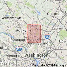
The age of the Guilford Granite is changed to Ordovician because the Guilford is probably comagmatic with the Woodstock Granite which has been dated at 444 Ma. The Guilford consists of light-gray, medium- to fine-grained, homogeneous monzogranite. In the Kensington quad., Montgomery Co., it intrudes the Northwest Branch Formation.
Source: GNU records (USGS DDS-6; Reston GNULEX).
For more information, please contact Nancy Stamm, Geologic Names Committee Secretary.
Asterisk (*) indicates published by U.S. Geological Survey authors.
"No current usage" (†) implies that a name has been abandoned or has fallen into disuse. Former usage and, if known, replacement name given in parentheses ( ).
Slash (/) indicates name conflicts with nomenclatural guidelines (CSN, 1933; ACSN, 1961, 1970; NACSN, 1983, 2005, 2021). May be explained within brackets ([ ]).

