

- Usage in publication:
-
- Grayson sandstone bed*
- Modifications:
-
- Informally named
- Dominant lithology:
-
- Sandstone
- AAPG geologic province:
-
- Appalachian basin
Summary:
Grayson sandstone bed in Breathitt Formation described as gray micaceous and quartzose sandstone. Unit is fine-grained and contains stigmarian roots. Thickness ranges from 0 to 1.5 m in study area. Underlies Wolf Creek coal bed. Age is Early and Middle Pennsylvanian.
Source: GNU records (USGS DDS-6; Reston GNULEX).
- Usage in publication:
-
- Grayson sandstone bed*
- Modifications:
-
- Revised
- AAPG geologic province:
-
- Appalachian basin
Summary:
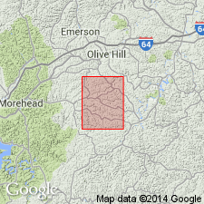
In the Ault quad. of northeastern KY, Grayson sandstone bed assigned to Lee Formation. Unit is light gray to white sandstone and conglomeratic sandstone. Age is Early and Middle Pennsylvanian.
Source: GNU records (USGS DDS-6; Reston GNULEX).

- Usage in publication:
-
- Grayson sandstone bed*
- Modifications:
-
- Areal extent
- AAPG geologic province:
-
- Appalachian basin
Summary:
Grayson sandstone bed (informal) of Lee Formation of Whittington and Fern (1967). Sandstone. Is intercalated with rocks of the Breathitt Formation, below Crummies Member and above Betsie Shale Member; lies between the Bruin (or Wolf Creek) and Wheelersburg coal beds. Correlative with Caywood [Cawood] Sandstone Member of Breathitt Formation in Upper Cumberland River district, southeastern Kentucky. (Shown higher in section than the Frozen Sandstone Member of Breathitt Formation in Hazard district, eastern Kentucky, which is at same level in section as the Wheelersburg and Dixie coals.) Age is Middle Pennsylvanian.
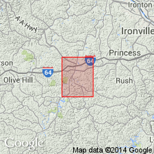
Recognized locally in Princess district, eastern KY.
[See also Chesnut, 1997 (revised Oct. 12, 1999), Stratigraphy of the coal-bearing strata of the Eastern Kentucky coal field, available online through the Kentucky Geol. Survey (http://www.uky.edu/KGS/coal/coalcorrel.htm). Shows Cawood Sandstone Member = Grayson sandstone and higher in section than (descending) Wheelersburg or Dixie coal, and Frozen Sandstone.]
Source: Publication.
For more information, please contact Nancy Stamm, Geologic Names Committee Secretary.
Asterisk (*) indicates published by U.S. Geological Survey authors.
"No current usage" (†) implies that a name has been abandoned or has fallen into disuse. Former usage and, if known, replacement name given in parentheses ( ).
Slash (/) indicates name conflicts with nomenclatural guidelines (CSN, 1933; ACSN, 1961, 1970; NACSN, 1983, 2005, 2021). May be explained within brackets ([ ]).