

- Usage in publication:
-
- Grass Valley formation*
- Modifications:
-
- Original reference
- Biostratigraphic dating
- Dominant lithology:
-
- Quartzite
- Slate
- AAPG geologic province:
-
- Great Basin province
Summary:
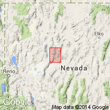
Type locality: northern part of East Range, west of Grass Valley, Winnemucca quad, Pershing Co, Nevada. Overlies Natchez Pass Formation; underlies Dan Glen formation. Consists of slate and quartzite in variable proportions; some limestone. Lower plate of Tobin thrust. In Tobin Range nearly all quartzite; in Stillwater Range up to 30% limestone, mostly in upper part, rest slate and quartzite. About 1800 ft thick in Tobin Range; 1300 ft in Stillwater Range. Brackish and marine conditions. Fossils scarce; HALABIA indicate Late Triassic age, probably Karnian; lenses of limestone with brachiopods, corals, and reefs of TRICHITES (pelecypod).
Ferguson et al GQ-11. Mapped in Winnemucca 30' quad, north central NV. Comprised of mainly shale, in part micaceous, olive-drab or black with prominent worm trails; interbedded white, gray, or black quartzite, locally cross-bedded and at type limestone near top. Thickness may exceed 2000 ft. Underlies Dun Glen formation. Overlies Natchez Pass formation. Contains thick-shelled pelecypods, TRICHITES, indicating sporadic existence of normal marine conditions. Age is Late Triassic (Karnian).
Source: GNU records (USGS DDS-6; Menlo GNULEX).
- Usage in publication:
-
- Grass Valley Formation*
- Modifications:
-
- Revised
- Areal extent
- Age modified
- AAPG geologic province:
-
- Great Basin province
Summary:
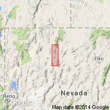
Type locality of Muller and others (1951) redesignated as type area; more geographically restricted type locality designated: secs 30, 31, and 32, T34N, R37E, and secs 24, 25, and 36, T34N, R36E, Rose Creek 15' quad, Pershing Co, NV. Named as lowest of 9 formations of Auld Lange Syne Group (new). Overlies Natchez Pass Formation (highest unit of Star Peak Group); contact is sharp, perhaps disconformable. Generally poorly exposed; small, tight folds in outcrops indicate unit has been much deformed. Formation is at least 2000 ft thick in type area; elsewhere in northern part of East Range no more than 300 ft thick. Also occurs in southern Santa Rosa Range (reference area), northern Sonoma Range, southern Humboldt Range, and northern Stillwater Range. Metamorphosed in Santa Rosa Range. Strata assigned to Grass Valley Formation in southern Tobin Range by Muller and others (1951) here reassigned to Osobb Formation. Age is early middle Norian (middle Late Triassic) in uppermost part of formation in Humboldt Range.
Source: GNU records (USGS DDS-6; Menlo GNULEX).
For more information, please contact Nancy Stamm, Geologic Names Committee Secretary.
Asterisk (*) indicates published by U.S. Geological Survey authors.
"No current usage" (†) implies that a name has been abandoned or has fallen into disuse. Former usage and, if known, replacement name given in parentheses ( ).
Slash (/) indicates name conflicts with nomenclatural guidelines (CSN, 1933; ACSN, 1961, 1970; NACSN, 1983, 2005, 2021). May be explained within brackets ([ ]).