

- Usage in publication:
-
- Graford formation
- Modifications:
-
- Original reference
- Dominant lithology:
-
- Shale
- Limestone
- Sand
- AAPG geologic province:
-
- Bend arch
Summary:
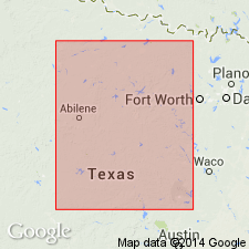
Pg. 133-145. Graford formation, 2nd from base of 4 formations in Canyon division. Composed largely of shale members with some thin limestones and a little sand. Top member is Graford limestone, one of most persistent, and can be recognized by greater height of its scarp than the other limestone members [unnamed] of the formation. The limestones are very fossiliferous, but shells are poorly preserved. Underlies Ranger formation and overlies Palo Pinto formation, both of Canyon division. Is approximately equivalent to (ascending) Adams Branch limestone, Cedarton bed, Clear Creek bed, and Bed No. 7 of Drake's (1893) Colorado River Valley section. [Age is Pennsylvanian.] Report area in Brazos River Valley, north-central Texas.
Type locality not designated. Orign of name not stated.
Source: US geologic names lexicon (USGS Bull. 896, p. 846-847); supplemental information from GNU records (USGS DDS-6; Denver GNULEX).

- Usage in publication:
-
- Graford formation
- Modifications:
-
- Principal reference
- Revised
- AAPG geologic province:
-
- Bend arch
- Fort Worth syncline
Summary:
Pg. 24, 31, 34; [Univ. Texas Bull., no. 2132, p. 95+]. Graford formation. In Brazos River Valley conformably overlies Palo Pinto limestone and underlies Seaman Ranch shale member of Brad formation. In Colorado River Valley it underlies Cedarton shale member of Brad formation. Includes Adams Branch limestone member at top (replaces Graford limestone) and Rochelle conglomerate at base. Thickness 170 to 450 feet. [Adams Banch limestone replaces Graford limestone member.]
Named from town of Graford, in Palo Pinto Co. [Brazos River region], TX, where it is typically developed, and where the upper members form prominent escarpment just west and north of town. [Age is Pennsylvanian.]
Source: US geologic names lexicon (USGS Bull. 896, p. 846-847).
- Usage in publication:
-
- Graford formation
- Modifications:
-
- Revised
- AAPG geologic province:
-
- Fort Worth syncline
Summary:
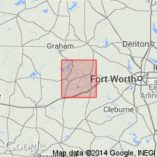
Pg. 33. Devils Den limestone is arbitrarily taken as top member of Graford formation in Wise County, Texas. It is an older limestone than Adams Branch limestone, which lenses out completely before Wise County is reached. [Age is Pennsylvanian.]
Source: US geologic names lexicon (USGS Bull. 896, p. 846-847).
- Usage in publication:
-
- Graford formation*
- Modifications:
-
- Revised
- Adopted
- AAPG geologic province:
-
- Bend arch
- Fort Worth syncline
Summary:
Pg. 104, 111. Graford formation of Canyon group. Extended top of Graford formation up to top of Clear Creek limestone of Drake, because "the top of the Graford formation as defined at type locality apparently falls within the Merriman (Clear Creek) limestone equivalent and not at the Adams Branch limestone as given in the original description." Also (p. 105, 109) he transferred Capps limestone from Graford formation to top of Strawn group, and included Devils Den limestone in Graford formation. This definition of Graford formation was adopted by the USGS in 1935. [Age is Pennsylvanian.]
Source: US geologic names lexicon (USGS Bull. 896, p. 846-847).
- Usage in publication:
-
- Graford formation
- Modifications:
-
- Revised
- AAPG geologic province:
-
- Bend arch
Summary:
Pg. 197+. Graford formation includes, in Colorado River region, all beds below top of Adams Branch limestone member and above base of Capps limestone lentil or, in some areas, base of Rochelle conglomerate.
Source: US geologic names lexicon (USGS Bull. 896, p. 846-847).
- Usage in publication:
-
- Graford formation
- Modifications:
-
- Revised
- AAPG geologic province:
-
- Bend arch
Summary:
Pg. 47-48. Graford formation was named by Plummer and Moore, and was made to include all strata from top of Palo Pinto limestone up to top of the limestone that caps the escarpment west of Graford. This escarpment-forming limestone, at time the formation was named, was thought to be = typical Adams Branch limestone to south. Later work by Cheney, Armstrong, and others has shown that true Adams Branch limestone in Palo Pinto County lies much lower in section than uppermost limestone of Graford formation, and that this uppermost limestone is = Merriman limestone of Reeves. The Graford formation of Palo Pinto County consists of Merriman limestone at top and 400+/- feet of shale containing lentils of sand, a lentil of coal, and a few thin layers of limestone, and is divided into following members (downward): (1) Merriman limestone, 20 to 75 feet, formerly mapped by Plummer and Moore as Adams Branch limestone; (2) Wolf Mountain shale; (3) Wiles limestone, 3 to 8 feet; (4) Posideon shale, 50+/- feet. Underlies Brad formation and overlies Palo Pinto limestone. The Brad formation is divided into Ranger limestone (above) and Seaman Ranch member (below). [Age is Pennsylvanian.]
Source: US geologic names lexicon (USGS Bull. 896, p. 846-847).

- Usage in publication:
-
- Graford formation*
- Modifications:
-
- Overview
- AAPG geologic province:
-
- Bend arch
- Fort Worth syncline
Summary:
[See also entry under Nickell, 1938, Univ. Texas Bur. Econ. Geol. Pub. 3801.] Wallace Lee and C.O. Nickell in their 1934 field work found it impracticable to draw line between Brad and Graford formations at top of †Clear Creek limestone (preoccupied) in Brazos River region, because this limestone is one of several limestones in this part of the column. They therefore adopted the new name Winchell member for the group of limestones and separating shales occurring in upper part of Graford formation as expanded by Sellards and in lower part of Placid shale member of Plummer and Moore in Colorado River region, and Merriman limestone member (4 feet thick) of Reeves in Brazos River region. Their report has been transmitted and will soon be published by Texas Geol. Survey.
Source: US geologic names lexicon (USGS Bull. 896, p. 846-847).

- Usage in publication:
-
- Graford formation
- Modifications:
-
- Revised
- AAPG geologic province:
-
- Bend arch
Summary:
Pg. 96-100. Graford formation. Redefined for Colorado River area. Winchell member (new) and Cedarton shale member (136 feet thick) are referred to as upper part of Graford and Adams Branch limestone and underlying shale (221 feet) referred to as lower Graford. Interval from top of Palo Pinto limestone of Cheney to top of Winchell member, an interval which may ultimately be found to include parts of Palo Pinto in other areas, is 357 feet. Underlies Brad formation (redefined). [Age is Late Pennsylvanian.]
Source: US geologic names lexicon (USGS Bull. 1200, p. 1556-1557).

- Usage in publication:
-
- Graford group
- Modifications:
-
- Revised
- AAPG geologic province:
-
- Bend arch
- Fort Worth syncline
Summary:
Pg. 66 (fig. 1), 88. Graford group. Rank raised to group. Restricted below to exclude beds nearly equivalent to the Brownwood and here included in Whitt group (new). Underlies Brad group. Includes (ascending) Adams Branch limestone, Cedarton shale, and Winchell limestone. [Age is Late Pennsylvanian.]
Source: US geologic names lexicon (USGS Bull. 1200, p. 1556-1557).
- Usage in publication:
-
- Graford group
- Modifications:
-
- Areal extent
- AAPG geologic province:
-
- Bend arch
Roth, Robert, 1956, [Fig. 2, columnar section]: North Texas Geological Society Field Trip Guidebook, May 25-26, 1956, [20 p.].
Summary:
Fig. 2. Generalized columnar section shows Grafton group comprises (ascending) Wolf Mountain shales and sandstone, Staff limestone (Adams Branch limestone), unnamed shale, and Winchell limestone; overlies Whitt group. [Age is Late Pennsylvanian.]
Source: US geologic names lexicon (USGS Bull. 1200, p. 1556-1557).
- Usage in publication:
-
- Graford formation
- Modifications:
-
- Areal extent
- AAPG geologic province:
-
- Bend arch
Summary:
Graford formation. Composite section of Brown and Coleman Counties, Texas, shows formation comprises (ascending) Brownwood shale, Adams Branch limestone, and Cedarton shale members. Underlies Winchell limestone. Thickness about 300 feet. [Age is Late Pennsyvlanian.]
Source: US geologic names lexicon (USGS Bull. 1200, p. 1556-1557).
- Usage in publication:
-
- Graford formation*
- Modifications:
-
- Revised
- AAPG geologic province:
-
- Bend arch
Summary:
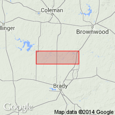
Pg. 63, pl. 27. Graford formation as defined by Plummer and Moore [1922] for locality in Palo Pinto County, Texas, was intended to include a thick limestone forming a prominent cuesta in that country, which they considered to be the Adams Branch, and the underlying shale, down to Palo Pinto limestone. They showed the Palo Pinto to be absent in Colorado River Valley and defined basal member of Graford as Brownwood shale (Drake's Brownwood bed), in which they included their Capps limestone lentil and Rochelle conglomerate. They considered Rochelle to underlie Capps lentil, although later workers have found it to be in position of Capps, or to be a channel-fill conglomerate and sandstone of later age which has replaced their Capps. Cheney (Univ. Texas Bull. 2913, 1929) showed that limestone at top of Graford in Palo Pinto County was not correlative with Adams Branch, but with part of limestone now called Winchell limestone. Sellards (Univ. Texas Bull. 3232, 1933) defined Graford to include his Merriman (equivalent to part of Winchell as later defined) and underlying Cedarton shale of Plummer and Moore [1922] as well as their Adams Branch limestone and Brownwood shale. He included, therefore, in one formation all units he considered equivalent in both Brazos and Colorado River valleys. Graford, as herein redefined for Colorado River Valley, includes (ascending) Brownwood shale (redefined), Adams Branch limestone, and Cedarton shale members. Underlies Winchell herein raised to rank of formation; overlies Strawn group. Thickness 285 feet in southern part of Brown County; 340 feet in central part of county. [Age is Late Pennsylvanian.]
Source: US geologic names lexicon (USGS Bull. 1200, p. 1556-1557).
- Usage in publication:
-
- Graford formation
- Modifications:
-
- Not used
- AAPG geologic province:
-
- Bend arch
Summary:
Name Graford formation, as defined by the USGS in 1960--with Brownwood shale member (at base), Adams Branch limestone, and Cedarton shale member (at top)--not used. Name Brookesmith, a new name, is proposed instead. Brookesmith includes Adams Branch limestone member (base) and Cedarton shale member (top). Area of report is the Colorado River Valley area, Brown Co, TX on Bend arch. Brookesmith overlies Brownwood formation (revised--removed as a shale member of Graford formation and rank raised to formation); underlies Winchell limestone. Stratigraphic chart. Of Canyon [Pennsylvanian] age. [Author does not capitalize rank terms; however, units are considered to be formal.]
Source: GNU records (USGS DDS-6; Denver GNULEX).
- Usage in publication:
-
- Graford Formation*
- Modifications:
-
- Age modified
- AAPG geologic province:
-
- Bend arch
Summary:
Graford Formation of Canyon Group assigned to "interval D," which corresponds closely to the Missouri Series of the Midcontinent region (Late Pennsylvanian). In north-central TX, on Bend arch, Graford Formation is divided into the following units: (A) in Colorado River Valley [according to Eargle, 1960], Graford is a Formation in Canyon Group, and is divided into (ascending) Brownwood Shale Member (with the Rochelle Conglomerate at base), Adams Branch Limestone Member, and Cedarton Shale Member; (B) in the Brazos River Valley [according to Abilene Geological Society, 1949], Graford is designated a Group in Canyon Series--Graford Group in this area is divided into Wolf Mountain Shale (at base) with its Adams Branch Limestone Member, and Winchell (or Merriam) Limestone Member (at top). Stratigraphic chart. Age is refined to Late Pennsylvanian (Missourian).
Source: GNU records (USGS DDS-6; Denver GNULEX).

- Usage in publication:
-
- Graford Formation
- Modifications:
-
- Not used
- AAPG geologic province:
-
- Fort Worth syncline
Summary:
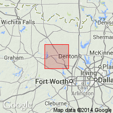
[On previous edition of this map (1967) the Pennsylvanian Graford Formation is mapped along western edge of map sheet, west of Lake Bridgeport, Jack and Wise Cos., central and northern TX, and subdivided into several members (separately mapped), the Devils Den Limestone Member, Jasper Creek Shale Member, Rock Hill Limestone Member, Lake Bridgeport Shale Member, and to the east, Chico Ridge Limestone Member. On 1991 edition of this map, the Devils Den and Rock Hill Limestone Members are transferred to formation-ranked Chico Ridge Limestone of Canyon Group; the Jasper Creek and Lake Bridgeport are considered informal, unranked units in the Jasper Creek Formation of Canyon Group; and the Graford Formation is not used. See also entries under Chico Ridge, Devils Den, Jasper Creek, Lake Bridgeport, and Rock Hill, and see adjacent Wichita Falls-Lawton sheet, Texas Geol. Atlas, 1987.]
Source: Publication.
For more information, please contact Nancy Stamm, Geologic Names Committee Secretary.
Asterisk (*) indicates published by U.S. Geological Survey authors.
"No current usage" (†) implies that a name has been abandoned or has fallen into disuse. Former usage and, if known, replacement name given in parentheses ( ).
Slash (/) indicates name conflicts with nomenclatural guidelines (CSN, 1933; ACSN, 1961, 1970; NACSN, 1983, 2005, 2021). May be explained within brackets ([ ]).