

- Usage in publication:
-
- Gosling volcanics*
- Modifications:
-
- Named
- Dominant lithology:
-
- Basalt
- Volcanics
- AAPG geologic province:
-
- Seward Peninsula province
- Alaska West-Central region
Summary:
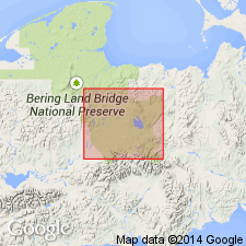
Named for Gosling Cone located at source vent of typical lava flow. Covers extensive areas between southeast end of Imuruk Lake, head of Kugruk Canyon, and headwaters of Kuzitrin River, Seward Peninsula, AK. Consists of group of basaltic and andesitic lava flows and endogenous domes that overlie silt mantle of Imuruk volcanics (new) and that are locally overlain by Camille lava flow (new) and Lost Jim lava flow. Thickness commonly is 10 to 50 ft, 150 to 300 ft near source vents. One of youngest flows assigned to unit has invaded canyon carved by Kugruk River in flows of Imuruk volcanics and Kugruk volcanics (new). Gosling volcanics were emplaced during Nome River-Salmon Lake (Sangamon) interglacial interval and Salmon Lake (Wisconsin) glacial interval. Age is Pleistocene.
Source: GNU records (USGS DDS-6; Menlo GNULEX).
For more information, please contact Nancy Stamm, Geologic Names Committee Secretary.
Asterisk (*) indicates published by U.S. Geological Survey authors.
"No current usage" (†) implies that a name has been abandoned or has fallen into disuse. Former usage and, if known, replacement name given in parentheses ( ).
Slash (/) indicates name conflicts with nomenclatural guidelines (CSN, 1933; ACSN, 1961, 1970; NACSN, 1983, 2005, 2021). May be explained within brackets ([ ]).