

- Usage in publication:
-
- Gorman Formation*
- Modifications:
-
- First used
- Dominant lithology:
-
- Limestone
- Dolomite
Summary:
Pg. 1, 8-19. Gorman formation. Limestone and dolomite. Thickness 426 feet. Overlies Tanyard formation (new); underlies Honeycut formation (new). Cherokee Creek section, San Saba County, central Texas, described. Age is Early Ordovician.
Source: US geologic names lexicon (USGS Bull. 1200, p. 1550).
- Usage in publication:
-
- Gorman formation
- Modifications:
-
- Original reference
- Dominant lithology:
-
- Limestone
- Dolomite
Summary:
Proposed that name Gorman formation be used to designate rocks similar to and correlative with those in the composite type section (herein designated). Basal zone characterized by varicolored and very fine-grained dolomites --yellows, pinks, browns; upper calcitic facies consists principally of sublithographic, thickly to thinly bedded limestone with locally interbedded microgranular to fine-grained dolomite; a sequence of pure, unusually thick-bedded limestone present in top 40 to 60 feet of formation. Dolomitic facies 81 to 230 feet thick; calcitic facies 237 to 393 feet. Chert common. Where not thinned by post-Ellenburger truncation, between 426 and 498 feet thick.
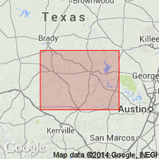
Type section: vicinity of Gorman Falls, along and near gorge of the Colorado River, San Saba Co., TX.
[Type section described in detail in Cloud and Barnes, 1948 [1946] (Univ. Texas Bur. Econ. Geol. Pub., no. 4621, p. 9-10, 39-40, 137-138, 158-159, 195-197, 227-229, 235-239, pls. 9, 35).]
Source: US geologic names lexicon (USGS Bull. 1200, p. 1550).
For more information, please contact Nancy Stamm, Geologic Names Committee Secretary.
Asterisk (*) indicates published by U.S. Geological Survey authors.
"No current usage" (†) implies that a name has been abandoned or has fallen into disuse. Former usage and, if known, replacement name given in parentheses ( ).
Slash (/) indicates name conflicts with nomenclatural guidelines (CSN, 1933; ACSN, 1961, 1970; NACSN, 1983, 2005, 2021). May be explained within brackets ([ ]).