

- Usage in publication:
-
- Gopher Ridge volcanics*
- Modifications:
-
- Mapped 1:62.5k
- Dominant lithology:
-
- Tuff
- Volcanic breccia
- AAPG geologic province:
-
- Sierra Nevada province
Summary:
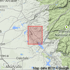
Gopher Ridge volcanics. Bedded mafic or intermediate tuff and volcanic breccia. Age is Late(?) Jurassic. Report includes cross section.
Source: US geologic names lexicon (USGS Bull. 1350, p. 299).
- Usage in publication:
-
- Gopher Ridge volcanics*
- Modifications:
-
- Named
- Dominant lithology:
-
- Volcanics
- AAPG geologic province:
-
- Sierra Nevada province
Summary:
Pg. 27-29, pls. 1-11 (see also L.D. Clark and others, 1963, San Andreas quadrangle, USGS Geol. Quad. Map GQ-222). Gopher Ridge volcanics. Consists largely of pyroclastic rocks but contains lavas with and without pillows. Base not exposed hence only partial thicknesses known. Exposed.part of Gopher Ridge below lowest bed of Salt Spring slate (new) is about 4,000 feet in Mokelumne River, 7,000 feet in Calaveras River, and 12,000 feet in Stanislaus River. Maximum exposed thickness, 15,000 feet, is in Stanislaus River. Intertongues with Salt Spring slate; underlies and intertongues with Merced Falls slate (new). Volcanics were mapped as diabase, porphyrite, and amphibolite schist by Turner (1894-1897). Included with Amador group by Taliaferro (1943, California Div. Mines Bull., no. 125) and Heyl and others (1948, California Div. Mines Bull. 144, pt. 2) and with Logtown Ridge formation by Taliaferro and Solari (1949, California Div. Mines Bull. 145, map only). Age is Late(?) Jurassic.
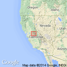
Underlies and is named for Gopher Ridge, a prominent topographic feature near west side of exposed belt of metamorphic rocks between Stanislaus and Calaveras Rivers, lower western slopes of the Sierra Nevada, Calaveras Co., central CA.
Source: US geologic names lexicon (USGS Bull. 1350, p. 299).
For more information, please contact Nancy Stamm, Geologic Names Committee Secretary.
Asterisk (*) indicates published by U.S. Geological Survey authors.
"No current usage" (†) implies that a name has been abandoned or has fallen into disuse. Former usage and, if known, replacement name given in parentheses ( ).
Slash (/) indicates name conflicts with nomenclatural guidelines (CSN, 1933; ACSN, 1961, 1970; NACSN, 1983, 2005, 2021). May be explained within brackets ([ ]).