

- Usage in publication:
-
- basalt of Goose Island*
- Modifications:
-
- Original reference
- Dominant lithology:
-
- Basalt
- AAPG geologic province:
-
- Eastern Columbia basin
Summary:
Pg. G6-G7 (fig. 2), G51-G52. basalt of Goose Island (informal) in Ice Harbor Member of Saddle Mountains Basalt of /Yakima basalt subgroup [informal] of Columbia River Basalt Group. Consists of tephra, associated thin flows, and overlying thick flow. Total thickness 15 m. Lies above basalt of Martindale and basalt of Basin City, both informal units in Ice Harbor Member of Saddle Mountains Basalt. Has transitional to normal polarity. Age is late Miocene; K-Ar age = 8.5 Ma (citing McKee and others [abs.], 1977, GSA Abs. with Prog., v. 9, no. 4, p. 463-464).
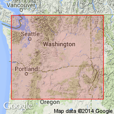
Named from Goose Island, a small island in the Snake River at the type locality of Ice Harbor Member (in SE/4 SE/4 sec. 22, T. 9 N., R. 31 E., Humorist quadrangle, Walla Walla Co., southeast WA).
Reference locality: in quarry 9.5 km northwest of Ice Harbor Dam, in SW/4 SE/4 sec. 29, T. 10 N., R. 31 E., Levey SW quadrangle; drifting sand sometimes makes roads to this quarry impassable to all but 4WD vehicles.
[Yakima basalt subgroup considered informal and should not be capitalized. "Subgroup" not recognized as a formal stratigraphic rank term (CSN, 1933; ACSN, 1961, 1970; NACSN, 1983, 2005, 2021). Columbia River Basalt Group adopted by the ID, OR, and WA Geol. Surveys, and the USGS.]
Source: Publication; US geologic names lexicon (USGS Bull. 1564, Ice Harbor entry p. 80).
For more information, please contact Nancy Stamm, Geologic Names Committee Secretary.
Asterisk (*) indicates published by U.S. Geological Survey authors.
"No current usage" (†) implies that a name has been abandoned or has fallen into disuse. Former usage and, if known, replacement name given in parentheses ( ).
Slash (/) indicates name conflicts with nomenclatural guidelines (CSN, 1933; ACSN, 1961, 1970; NACSN, 1983, 2005, 2021). May be explained within brackets ([ ]).