

- Usage in publication:
-
- Goose Creek Conglomerate Member
- Modifications:
-
- Named
- Dominant lithology:
-
- Conglomerate
- Sandstone
- Mudstone
- AAPG geologic province:
-
- Culpeper basin
Summary:
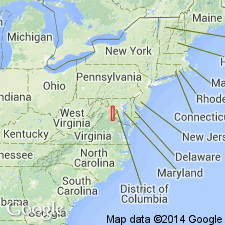
Outcrops of greenish and grayish pebble conglomerate along Goose Creek, Loudoun Co., Virginia, are here named the Goose Creek Conglomerate Member of the Bull Run Formation. The outcrop belt extends from north of Haymarket, Prince William Co., northward for 32 km (20 mi). The conglomerate lenses are irregular in shape and are separated laterally by sandstone and mudstone. Clasts were derived from Catoctin, Chilhowee, and Weverton metamorphic rocks. Thickness exceeds 900 m (3,000 ft). Age is Late Triassic.
Source: GNU records (USGS DDS-6; Reston GNULEX).

- Usage in publication:
-
- Goose Creek Member*
- Modifications:
-
- Revised
- Redescribed
- AAPG geologic province:
-
- Culpeper basin
Summary:
The Goose Creek Conglomerate Member of Lindholm (1979), of the Bull Run Formation, is here revised and accepted by the U.S. Geological Survey as the Goose Creek Member of the Catharpin Creek Formation. It forms discontinuous and irregular lenses of red-brown cobble and pebble conglomerate composed mostly of quartz, quartzite, and other metamorphic rocks, at the top of the Catharpin Creek, and it grades laterally and vertically into arkosic sandstones of the Catharpin Creek. It paraconformably underlies the Mount Zion Church Basalt. Thickness exceeds 900 m (3,000 ft). Age is Late Triassic and Early Jurassic (late Norian and early Hettangian) based on its stratigraphic position.
Source: GNU records (USGS DDS-6; Reston GNULEX).
For more information, please contact Nancy Stamm, Geologic Names Committee Secretary.
Asterisk (*) indicates published by U.S. Geological Survey authors.
"No current usage" (†) implies that a name has been abandoned or has fallen into disuse. Former usage and, if known, replacement name given in parentheses ( ).
Slash (/) indicates name conflicts with nomenclatural guidelines (CSN, 1933; ACSN, 1961, 1970; NACSN, 1983, 2005, 2021). May be explained within brackets ([ ]).