

- Usage in publication:
-
- Goldman Meadows Formation*
- Modifications:
-
- Named
- Dominant lithology:
-
- Schist
- Quartzite
- Iron-formation
- AAPG geologic province:
-
- Northern Rocky Mountain region
Summary:
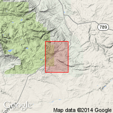
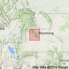
Named for Goldman Meadows, Fremont Co, WY in the Northern Rocky Mountain region. Type locality located on northwest side of meadows in sec 26, T30N, R100W. Composed of 1) feldspathic quartz-mica schist, 2) white, gray or pale green vitreous quartzite with thin interbeds of pale-green muscovite schist, 3) chlorite-quartz schist, hornblende-garnet-magnetite schist, quartz-mica schist, and quartz-mica-andalusite schist, 4) lower and a main iron-formation members, and 5) hornblende-garnet-magnetite schist, chlorite-garnet schist, and quartz-mica-andalusite schist. Main iron-formation member is laminated, thin-bedded and composed chiefly of quartz and magnetite; average iron content is 30 percent. Total thickness given as 190+ ft. Is older than Roundtop Mountain Greenstone (new). Assigned an early Precambrian age.
Source: GNU records (USGS DDS-6; Denver GNULEX).
- Usage in publication:
-
- Goldman Meadows Formation*
- Modifications:
-
- Age modified
- Geochronologic dating
- AAPG geologic province:
-
- Northern Rocky Mountain region
Summary:
Miners Delight, Roundtop Mountain, and Goldman Meadows Formations shown with the oldest of the Archean rocks in a map unit called "Metasedimentary and metavolcanic rocks." Also shown as equivalent to map unit called "clinopyroxene-hornblende-biotite quartzofeldspathic gneiss" which bears a date of 3,358 +/-30 m.y. (Zr), and older than two Late Archean units which bear dates of 2,504 +/-40 m.y. to 2,575 +/-50 m.y. (using U-Pb subscript x Zr, Rb-Sr, Th-Pb, Pb-Pb and U-Pb methods) and of 2,620 +/-27 m.y. to 2,642 +/-13 m.y. (using U-Pb subscript x Zr, Rb-Sr, Th-Pb, Pb-Pb and U-Pb methods). Is in the Northern Rocky Mountain region.
Source: GNU records (USGS DDS-6; Denver GNULEX).
- Usage in publication:
-
- Goldman Meadows Formation
- Modifications:
-
- Contact revised
- Overview
- AAPG geologic province:
-
- Northern Rocky Mountain region
Summary:
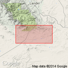
Is one of four formations belonging to the South Pass greenstone belt. Lower contact revised in that Goldman Meadows overlies the newly named Diamond Springs Formation. Rock types identified in the Goldman Meadows include quartzite, banded iron-formation, pelitic schist, and amphibolite. Bayley's "type exposures" are now buried by the Atlantic City mine tailings and are submerged under a lake occupying the open pit. Some good exposures are about 1 mi northwest of mine in sec. 24. Traceable for nearly 5 mi along east flank of belt. Mapped (geologic map) at north side near Atlantic City mine. Iron-formation and schist members mapped and described. The iron-formation member is black to dark gray, fine-grained, has hornsfelsic microtexture, is highly magnetic, hard, dense, laminated with alternating layers of magnetite and metachert. Layers are 0.1 to 2 in thick. Well foliated lenses and selvages of quartz-chlorite-schist, chlorite-garnet schist, and chlorite-amphibole-garnet-magnetite schist are interlayered with the iron-formation. The schist member includes pelitic schist, quartzite, and massive to schistose, amphibolites. The few amphibolites are thin, strongly foliated, hornblendic. Deposited in shallow water on stable platform. The deposits were eroded from a nearby shelf; erosion on shelf interrupted by volcanic activity. Archean age. Unconformably overlain by Roundtop Mountain Greenstone.
Source: GNU records (USGS DDS-6; Denver GNULEX).
For more information, please contact Nancy Stamm, Geologic Names Committee Secretary.
Asterisk (*) indicates published by U.S. Geological Survey authors.
"No current usage" (†) implies that a name has been abandoned or has fallen into disuse. Former usage and, if known, replacement name given in parentheses ( ).
Slash (/) indicates name conflicts with nomenclatural guidelines (CSN, 1933; ACSN, 1961, 1970; NACSN, 1983, 2005, 2021). May be explained within brackets ([ ]).