

- Usage in publication:
-
- Gold Hill formation*
- Modifications:
-
- Mapped 1:125k
- Dominant lithology:
-
- Quartzite
- Schist
- Slate
- AAPG geologic province:
-
- Great Basin province
Summary:
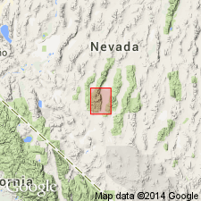
Mapped in north-central and central part of quad within Toyabe Range and in southwest part of quad within Toquima Range, Nye Co, NV, Great Basin province. Consists mainly of quartzite, quartz mica schist with some slate, and beds of dolomitic limestone with some oolitic limestone occurring locally in upper part. Probably equivalent to part of Silver Peak group of Silver Peak quad. Base not exposed; estimated thickness is 3000 ft. Unfossiliferous at type (Gold Hill in Manhattan district). Contains no fossils in study area, but a trilobite of Early Cambrian age (OLENELLUS GILBERTI Meek) was found in rocks of same lithology and stratigraphic position in Toyabe Range near Jett Canyon. Upper Cambrian beds may also be present as contact with overlying Palmetto formation appears to be conformable (on explanation of map units, contact shown to be a probable disconformity). Is oldest unit in study area. Assigned Cambrian age.
Source: GNU records (USGS DDS-6; Denver GNULEX).
For more information, please contact Nancy Stamm, Geologic Names Committee Secretary.
Asterisk (*) indicates published by U.S. Geological Survey authors.
"No current usage" (†) implies that a name has been abandoned or has fallen into disuse. Former usage and, if known, replacement name given in parentheses ( ).
Slash (/) indicates name conflicts with nomenclatural guidelines (CSN, 1933; ACSN, 1961, 1970; NACSN, 1983, 2005, 2021). May be explained within brackets ([ ]).