

- Usage in publication:
-
- Glen Rose beds
- Modifications:
-
- Original reference
- Dominant lithology:
-
- Limestone
- Chalk
- Marl
- AAPG geologic province:
-
- Bend arch
- Fort Worth syncline
- Gulf Coast basin
- Kerr basin
- Llano uplift
- Ouachita folded belt
- Permian basin
- Strawn basin
Summary:
Pg. 504, 507. Glen Rose or alternating beds. Soft yellow magnesium fossiliferous beds, siliceous at base, alternating with fine argillaceous sand with occassional dimension layers of almost pure crystalline limestones, chalk, and magnesium limestones, often oolitic in structure. Overlies Trinity or Basal sands and underlies Paluxy sands. [Age is Early Cretaceous (Comanche).]
[Named from Glen Rose, Somervell Co., TX.]
Source: US geologic names lexicon (USGS Bull. 896, p. 830).

- Usage in publication:
-
- Glen Rose limestone*
- Modifications:
-
- Overview
- AAPG geologic province:
-
- Bend arch
- Fort Worth syncline
- Gulf Coast basin
- Kerr basin
- Llano uplift
- Ouachita folded belt
- Permian basin
- Strawn basin
Summary:
Glen Rose limestone. Middle formation of Trinity group. Underlies Paluxy sand and overlies Travis Peak sand (†Basal sands.) Age is Early Cretaceous (Comanche).
Named from Glen Rose, Somervell Co., TX.
Source: US geologic names lexicon (USGS Bull. 896, p. 830).
- Usage in publication:
-
- Glen Rose subgroup
- Modifications:
-
- Revised
Summary:
Pg. 155-165. Glen Rose subgroup of Trinity group consists of Lower Glen Rose formation, Glen Rose anhydrite, and Upper Glen Rose formation. Lower Glen Rose indudes Pine Island member below and Rodessa member above. Overlies "Travis Peak" formation; underlies Paluxy formation. Subsurface data. [Age is Early Cretaceous.]
Source: US geologic names lexicon (USGS Bull. 1200, p. 1527).
- Usage in publication:
-
- Glen Rose limestone member
- Modifications:
-
- Revised
- AAPG geologic province:
-
- Llano uplift
Summary:
Pg. 5, 8. Glen Rose limestone member of Shingle Hills formation. Rank reduced to member status in Shingle Hills formation (new). Overlies Hensell sand member. [Age is Early Cretaceous.]
Source: US geologic names lexicon (USGS Bull. 1200, p. 1527).
- Usage in publication:
-
- Glen Rose limestone
- Modifications:
-
- Areal extent
Summary:
p. 67-78. Glen Rose limestone of Trinity group. At generalized reference section of Trinity division, Glen Rose limestone consists of lower unit and an upper unit. Lower subdivision, that is interval below CORBULA bed, is predominantly massive medium- to thick-bedded limestone with local mound-like concentrations of corals and caprinids in basal and upper parts. The lower Glen Rose above the massive limestone is largely shale alternating with thin-bedded limestones and is highly fossiliferous with several levels of ORBITULINA, the large Foraminifera used as a subsurface Glen Rose marker. Trinity section above CORBULA bed consists predominantly of buff-colored shales and fine-grained dolomites in lower and upper parts with darker shales and more resistant fossiliferous limestone in middle. The alternating relation of these lithic types resulted in early designation of "Alternating Beds" for the Glen Rose strata. Formal name was proposed by Hill (1891) from exposures near Glen Rose, Somervell County, Texas. Upper limit of Glen Rose in this area is placed at concordant contact of uppermost dolomitic section with overlying limestones similar to those higher in Fredericksburg division. Glen Rose is completely exposed from Hamilton Pool eastward to the Shingle Hills and has local thickness of 525 feet. Overlies Hensell sand. Lower Glen Rose contains basal coral reef at narrows of Blanco River. [Age is Early Cretaceous.]
Source: US geologic names lexicon (USGS Bull. 1200, p. 1527).
- Usage in publication:
-
- Glen Rose undifferentiated
- Glen Rose subgroup
- Glen Rose limestone
- Modifications:
-
- Areal extent
Summary:
Pg. 2328-2363. Terms Glen Rose, Glen Rose undifferentiated, and Glen Rose subgroup, as used in this report [stratigraphy of Comanchean Cretaceous Trinity group], all refer to those rocks below top of Glen Rose as defined in Austin area and above top of either Pearsall formation or its equivalent. These terms are used in areas where the Ferry Lake is not recognizable. Undifferentiated Glen Rose time-stratigraphic unit is defined to include those rocks below isochronous surface contemporaneous with top of Glen Rose as defined in Austin area and above isochronous surface contemporaneous with base of Rodessa formation as defined in type area. Rusk formation (new) occupies stratigraphic interval formerly termed upper Glen Rose formation and Paluxy formation. Top of Trinity group, as term is used in present report, is defined as top of Glen Rose formation of the Austin area and its equivalents. Subsurface data. [Age is Early Cretaceous.]
Source: US geologic names lexicon (USGS Bull. 1200, p. 1527).
- Usage in publication:
-
- Glen Rose formation
- Modifications:
-
- Revised
- AAPG geologic province:
-
- Gulf Coast basin
Summary:
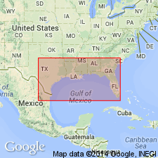
Pg. 15, 21; 1962, IN Contributions to the geology of south Texas: San Antonio, South Texas Geol. Soc., p. 86, figs. 11-15. Glen Rose formation assigned to Atascosa group (new). Age is Early Cretaceous (Comanchean).
Report area in subsurface of southwestern TX, notably Atascosa Co.
Source: GNC index card files (USGS-Reston); US geologic names lexicon (USGS Bull. 1350, Atascosa entry p. 35).
- Usage in publication:
-
- Glen Rose Limestone*
- Modifications:
-
- Mapped 1:62.5k
- Dominant lithology:
-
- Limestone
- AAPG geologic province:
-
- Permian basin
Summary:
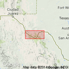
Glen Rose Limestone. Gray limestone exposed in bottom of Rio Grande Canyon, eastern Brewster County, western Texas. Underlies Maxon Limestone. Age is Early Cretaceous.
Source: Modified from GNU records (USGS DDS-6; Denver GNULEX).

- Usage in publication:
-
- Glen Rose Formation
- Modifications:
-
- Mapped 1:250k
- Dominant lithology:
-
- Limestone
- Dolomite
- Clay
- AAPG geologic province:
-
- Ouachita folded belt
Summary:
Glen Rose Formation. Alternating limestone, dolomite, and clay; limestone, fine-grained, chalky to hard, white to light gray; dolomite, fine- to very fine-grained, porous, medium gray to brownish gray; clay, marly, in part silty, laminated, dark gray. Thickness about 800 feet; upper 100 feet crops out in this sheet. Underlies Edwards Limestone (Lower Cretaceous). Age is Early Cretaceous; is oldest bedrock unit mapped in this sheet.
Mapped in Hays Co., southeastern TX.
Source: Modified from GNU records (USGS DDS-6; Denver GNULEX).

- Usage in publication:
-
- Glen Rose Formation
- Modifications:
-
- Mapped 1:250k
- Dominant lithology:
-
- Limestone
- Dolomite
- Marl
- AAPG geologic province:
-
- Gulf Coast basin
- Kerr basin
- Ouachita folded belt
- Permian basin
Summary:
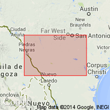
Glen Rose Formation. Limestone, dolomite, and marl as alternating resistant and recessive beds forming stair-step topography. Limestone, aphanitic to fine-grained, hard to soft and marly, light-gray to yellowish-gray. Dolomite, fine-grained, porous, yellowish-brown. Underlies Fort Terrett Member of Edwards Limestone, Devils River Limestone, and West Nueces Formation. Fossiliferous; marine megafossils include molluscan steinkerns, rudistids, oysters, and echinoids. Age is Early Cretaceous.
Exposed in Edwards, Kinney, Real, and Uvalde Cos., TX. In subsurface of northern Maverick County, Texas, thickness about 1,750 feet.
Source: Modified from GNU records (USGS DDS-6; Denver GNULEX).
- Usage in publication:
-
- Glen Rose Formation
- Modifications:
-
- Mapped 1:250k
- Dominant lithology:
-
- Limestone
- Marl
- AAPG geologic province:
-
- Permian basin
Summary:
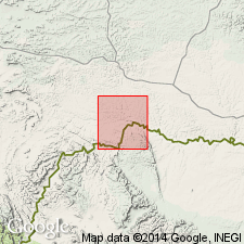
Glen Rose Formation. Mapped in Brewster and Presidio Counties, Texas. Consists of alternating resistant limestone ledges and soft marls which weather to form a characteristic stairstep topography; in the Solitario Uplift, because of narrow outcrop width, a basal conglomerate resting on Paleozoic rocks and local patches of limestone and marl of the Glen Rose beneath a much younger felsite sill are included with the sill that encircles the rim; the remaining 900 feet or so above the felsite sill is characteristic of the Glen Rose to the east; also includes basal Cretaceous conglomerate in Horseshoe Mesa-Pine Mountain area. Thickness 335 to 500 feet in Big Bend National Park and northward, rests on Paleozoic rocks, 733 feet measured in Black Gap area, base not exposed. Overlies Paleozoic rocks. Underlies Maxon Sandstone in vicinity of Santiago Mountains and central Brewster County; southward (where Maxon has feathered out) underlies Telephone Canyon Formation. Age is Early Cretaceous.
Source: Publication; supplemental information from GNU records (USGS DDS-6; Denver GNULEX).

- Usage in publication:
-
- Glen Rose Formation
- Modifications:
-
- Mapped 1:250k
- Dominant lithology:
-
- Limestone
- Dolomite
- Marl
- AAPG geologic province:
-
- Kerr basin
- Llano uplift
- Ouachita folded belt
Summary:
Glen Rose Formation. Limestone, dolomite, and marl as alternating resistant and recessive beds forming stair-step topography. Limestone, aphanitic to fine-grained, hard to soft and marly, light-gray to yellowish gray. Dolomite, fine-grained, porous, yellowish brown. Fossiliferous; marine megafossils include molluscan steinkerns, rudistids, oysters, and echinoids. Upper part relatively thinner bedded, more dolomitic, and less fossiliferous; thickness about 400 feet. Lower part more massive, contains some rudistid reefs and at top CORBULA-bearing bed with abundant steinkerns of CORBULA HARVEYI (Hill) in an interval up to 5 feet thick; thickness about 500 feet. Total thickness 900 feet. Age is Early Cretaceous.
Mapped across northern part of map sheet, in Bandera, Bexar, Comal, Hays, Kendall, Kerr, Medina, Real, and Uvalde Cos., TX.
Source: Publication.

- Usage in publication:
-
- Glen Rose Formation
- Modifications:
-
- Mapped 1:250k
- Dominant lithology:
-
- Limestone
- Clay
- Marl
- Sand
- AAPG geologic province:
-
- Fort Worth syncline
- Strawn basin
Summary:
Glen Rose Formation. Limestone, alternating with units composed of variable amounts of clay, marl, and sand. Thickness 40 to 200 feet, thins northward. Gradationally overlies Twin Mountains Formation; bench-forming beds are included in the Glen Rose. Gradationally underlies Paluxy Formation. Age is Early Cretaceous.
[Mapped in Bosque, Erath, Hood, Parker, and Somervell Cos., TX.]
Source: Publication.
- Usage in publication:
-
- Glen Rose Group
- Modifications:
-
- Revised
- AAPG geologic province:
-
- Arkla basin
Summary:
Pg. 104 (fig. 1). Glen Rose Group. Raised to group rank in subsurface of Bossier Parish, northwestern Louisiana (Sligo field). Includes (descending) Mooringsport Limestone, Ferry Lake Anhydrite, Rodessa Formation, and Pearsall Formation. Age is Early Cretaceous (Comanche; Aptian to Albian).
Source: GNC index card files (USGS-Reston).

- Usage in publication:
-
- Glen Rose Formation
- Modifications:
-
- Mapped 1:250k
- Dominant lithology:
-
- Limestone
- Clay
- Sand
- AAPG geologic province:
-
- Fort Worth syncline
Summary:
Pamphlet [p. 6]. Glen Rose Limestone. Limestone, clay, and sand; limestone, brownish-yellow, gray, argillaceous, silty, sandy, thin-bedded; clay, in part sandy; sand, gray to brownish-yellow. Thickness approximately 40 feet, pinches out northward. [Correlative with middle part of Antlers Sand.] Lies above Twin Mountains Formation and below Paluxy Sand. Age is Early Cretaceous.
[Mapped southwest of Decatur, in Jack, Parker, and Wise Cos., central northern TX; in southwestern corner of map sheet.]
Source: Publication.
- Usage in publication:
-
- Glen Rose Formation
- Modifications:
-
- Biostratigraphic dating
- AAPG geologic province:
-
- Strawn basin
Summary:
Glen Rose Formation of Trinity Group. Underlies Paluxy Formation and overlies Twin Mountains Formation (both of Trinity). Age is Early Cretaceous (early Albian).
Fossil locality: De Cordova Bend Dam on Lake Granbury, Brazos River, Hood Co., north-central TX.
Source: GNC index card files (USGS-Reston).
For more information, please contact Nancy Stamm, Geologic Names Committee Secretary.
Asterisk (*) indicates published by U.S. Geological Survey authors.
"No current usage" (†) implies that a name has been abandoned or has fallen into disuse. Former usage and, if known, replacement name given in parentheses ( ).
Slash (/) indicates name conflicts with nomenclatural guidelines (CSN, 1933; ACSN, 1961, 1970; NACSN, 1983, 2005, 2021). May be explained within brackets ([ ]).