

- Usage in publication:
-
- Gilbert andesite*
- Modifications:
-
- Named
- Mapped
- Dominant lithology:
-
- Andesite
- Basalt
- Volcaniclastics
- AAPG geologic province:
-
- Great Basin province
Summary:
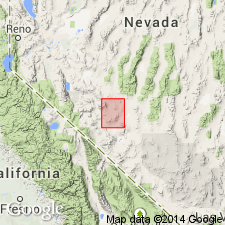
Gilbert andesite. Consists of flows and agglomerates, dominantly andesitic but also containing basalt which cover crest of Monte Cristo Range. Contains typically dark porphyritic lava, few flows of hornblende andesite, hypersthene and olivine basalt, and locally sandstone, conglomerate and fanglomerate between flows. Thickness between 500 and 1000 feet. Unconformably overlies rhyolite. Age is Pliocene.
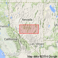
Type locality: exposures in southern part of Gilbert district, Monte Cristo Range, [Esmeralda Co.] southwestern NV.
Source: Modified from GNU records (USGS DDS-6; Menlo GNULEX).
- Usage in publication:
-
- Gilbert andesite*
- Modifications:
-
- Areal extent
- Age modified
- AAPG geologic province:
-
- Great Basin province
Summary:
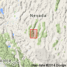
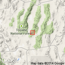
Small outcrops mapped in valley of Peavine Creek, Toiyabe Range, Round Mountain 30' quad, NV. Described as andesitic flows unconformable on and intrusive into Esmeralda formation. Unconformably underlies Toyabe [Toiyabe] quartz latite (new). Age given as Pliocene.
Source: GNU records (USGS DDS-6; Menlo GNULEX).
- Usage in publication:
-
- Gilbert andesite*
- Modifications:
-
- Areal extent
- AAPG geologic province:
-
- Great Basin province
Summary:
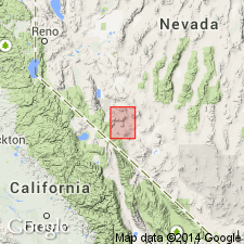
Mapped in Mina 30' quad, Mineral Co, NV. Described as andesite flows grading to basalt, with much andesitic breccia and agglomerate. Correlated with Gilbert andesite of Coaldale quad on basis of lithology and relation to underlying rhyolite where present. Age given as Pliocene(?).
Source: GNU records (USGS DDS-6; Menlo GNULEX).
- Usage in publication:
-
- Gilbert Andesite*
- Modifications:
-
- Geochronologic dating
- Age modified
- AAPG geologic province:
-
- Great Basin province
Summary:
Gilbert Andesite. Sample from porphyritic biotite-pyroxene andesite, at Lat. 37 deg. 07 min. 58 sec. N., Long. 117 deg. 42 min. 29 sec. W., in sec. 9, T. 3 N., R. 38 E., Esmeralda County, Nevada, yielded a K-Ar age on biotite 15.1 +/-0.5 Ma; on plagioclase 13.6 +/-0.4 Ma. [Age is at least in part middle Miocene based on time scale of Berggren (1972, Lethaia, v. 5, no. 2, p. 195-215).]
Source: Modified from GNU records (USGS DDS-6; Menlo GNULEX).
- Usage in publication:
-
- Gilbert Andesite*
- Modifications:
-
- Areal extent
- AAPG geologic province:
-
- Great Basin province
Summary:
Gilbert Andesite as used by Ferguson and Cathcart (1954) in southern Toiyabe Range is mapped with andesitic rocks on map of northern Nye Co, NV. However unit here "is probably much older than and unrelated to the type Gilbert Andesite." Occurs as dikes and flows and a possible vent complex in southern Toiyabe Range. Also shown on map in southern Monitor Range.
Source: GNU records (USGS DDS-6; Menlo GNULEX).
- Usage in publication:
-
- Gilbert Andesite*
- Modifications:
-
- Areal extent
- Geochronologic dating
- AAPG geologic province:
-
- Great Basin province
Summary:
Gilbert Andesite geographically restricted from Manhattan district in southern Toquima Range. Rocks previously mapped as such are now designated the Crone Gulch Andesite (new). Rocks in the Manhattan area are from different volcanic source and are older (latest Oligocene or earliest Miocene; K-Ar (plagioclase) and fission-track (apatite) age of about 22 Ma, Shawe and others, in press). Gilbert Andesite is middle Miocene (K-Ar age 15.1 +/-0.6 Ma).
Source: GNU records (USGS DDS-6; Menlo GNULEX).
- Usage in publication:
-
- Gilbert andesite
- Modifications:
-
- Geochronologic dating
- AAPG geologic province:
-
- Great Basin province
Summary:
Pg. 6, 7, geologic time scale (inside front cover). Gilbert andesite. Sample from Gilbert andesite at south end of Excelsior Mountains, Mina region, Lat. 38 deg. 14 min. 12 sec. N., Long. 118 deg. 09 min. 44.4 sec. W., Belleville 7.5-min quadrangle, Mineral Co., NV, yielded a K-Ar age on plagioclase 17.8 +/-0.6 Ma; on hornblende 17.7 +/-1.1 Ma [Miocene]. Decay constants, recommended by the IUGS Subcommission on Geochronology (Steiger and Jager, 1977, Earth and Planetary Science Letters, v. 36, p. 359-362) are used.
Source: Publication.
For more information, please contact Nancy Stamm, Geologic Names Committee Secretary.
Asterisk (*) indicates published by U.S. Geological Survey authors.
"No current usage" (†) implies that a name has been abandoned or has fallen into disuse. Former usage and, if known, replacement name given in parentheses ( ).
Slash (/) indicates name conflicts with nomenclatural guidelines (CSN, 1933; ACSN, 1961, 1970; NACSN, 1983, 2005, 2021). May be explained within brackets ([ ]).