

- Usage in publication:
-
- Gem Hill formation*
- Modifications:
-
- Named
- Dominant lithology:
-
- Tuff
- Sandstone
- Agglomerate
- Conglomerate
- AAPG geologic province:
-
- Mojave basin
Summary:
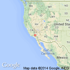
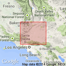
Named as formation in Tropico group (new) for Gem Hill in Rosamond Hills. Type locality designated as Gem Hill, S/2 sec.25, SE/4 sec.26 and NE/4 sec.35 T10N R13W, 5.5 mi northwest of Rosamond, Rosamond 15' quad, Kern Co, CA. Exposed southeastward 7 mi to Red Hill and at various places in Elizabeth Lake 15' quad or Willow Springs 15' and Rosamond 15' quads. Includes Bobtail quartz latite member (new). Consists mainly of stratified light-colored rhyolitic lithic tuff, tuff-breccia, tuffaceous sandstone, volcanic agglomerate, and some conglomerate. At Gem Hill is 1250 ft thick; at Antelope Buttes, about 1200 ft thick. Tentatively set at Miocene(?) age based on stratigraphic correlation.
Source: GNU records (USGS DDS-6; Menlo GNULEX).
- Usage in publication:
-
- Gem Hill Formation*
- Modifications:
-
- Age modified
- AAPG geologic province:
-
- Mojave basin
Summary:
Gem Hill Formation of Tropico Group may be Oligocene(?) to middle Miocene(?) based on stratigraphic correlation.
Source: GNU records (USGS DDS-6; Menlo GNULEX).
For more information, please contact Nancy Stamm, Geologic Names Committee Secretary.
Asterisk (*) indicates published by U.S. Geological Survey authors.
"No current usage" (†) implies that a name has been abandoned or has fallen into disuse. Former usage and, if known, replacement name given in parentheses ( ).
Slash (/) indicates name conflicts with nomenclatural guidelines (CSN, 1933; ACSN, 1961, 1970; NACSN, 1983, 2005, 2021). May be explained within brackets ([ ]).