

- Usage in publication:
-
- Galesburg shales*
- Modifications:
-
- Named
- Dominant lithology:
-
- Shale
- AAPG geologic province:
-
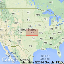
- Cherokee basin
Summary:
Pg. 36. Galesburg shales. Previously called Mound Valley shales. Fossiliferous, sandy shales, 75 to 100 feet thick, underlying Dennis limestone and overlying Hertha limestone. Thickness about 100 feet near Mound Valley, Labette County, Kansas; about 75 feet in vicinity of Galesburg, Neosho County, Kansas; thins rapidly northward along the Neosho River. Age is Pennsylvanian.
[GNC remark (ca. 1935, US geologic names lexicon, USGS Bull. 896, p. 791-792): Later work proved this lower limestone not to be Hertha but the younger Bethany Falls limestone.]
Source: US geologic names lexicon (USGS Bull. 896, p. 791-792); supplemental information from GNU records (USGS DDS-6; Denver GNULEX).
- Usage in publication:
-
- Galesburg shale member
- Modifications:
-
- Revised
- AAPG geologic province:
-
- Cherokee basin
Summary:
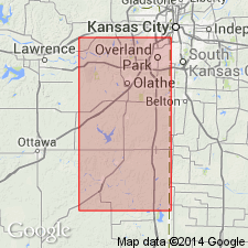
Galesburg shale member of Kansas City formation (5 to 10 feet thick in northwestern Missouri) underlies Winterset ("Dennis") limestone member (25 to 40 feet thick) and overlies Bethany Falls limestone member.
[GNC remark (ca. 1935, US geologic names lexicon, USGS Bull. 896, p. 791-792): This definition of Galesburg shale was followed for many years. In Kansas, the Kansas City deposits are treated as a group by the USGS and Galesburg shale as a formation. In southeastern Kansas the Galesburg is treated as a member of Coffeyville formation.]
Source: US geologic names lexicon (USGS Bull. 896, p. 791-792); GNC KS-NE Pennsylvanian Corr. Chart, sheet 1, Oct. 1936.
- Usage in publication:
-
- Galesburg shale
- Modifications:
-
- Revised
- AAPG geologic province:
-
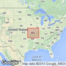
- Forest City basin
Summary:
Stated that Stark shale and Canville limestone are present at both Dennis and at Galesburg, and that they are included in Galesburg shale of Kansas City area, but he includes them in the Dennis, as explained under Dennis limestone. [See entry under Dennis.]
Source: US geologic names lexicon (USGS Bull. 896, p. 791-792); GNC KS-NE Pennsylvanian Corr. Chart, sheet 2, Oct. 1936.

- Usage in publication:
-
- Galesburg shale
- Modifications:
-
- Overview
- AAPG geologic province:
-
- Cherokee basin
Summary:
In 1932 (Kansas Geol. Soc. 6th Ann. Field Conf. Gdbk., p. 91, 97) R.C. Moore (1) revived Dennis limestone; (2) divided it into (descending) Winterset limestone member ("same as Winterset as previously recognized in Kansas and Missouri"), Stark shale member, and Canville limestone member; and (3) stated: So-called Galesburg shale of Kansas City is mainly Stark shale. Moore also assembled Bethany Falls limestone and underlying beds into a formation which he named Swope limestone (q.v.), and assembled Dennis, Galesburg, and his Swope limestone into his Bronson group.
Source: US geologic names lexicon (USGS Bull. 896, p. 791-792); GNC KS-NE Pennsylvanian Corr. Chart, sheet 2, Oct. 1936.

- Usage in publication:
-
- Galesburg shale
- Modifications:
-
- Revised
- AAPG geologic province:
-
- Cherokee basin
Summary:
Pg. 92+. Galesburg shale. In Linn County [Kansas], where Canville limestone disappears, Stark shale rests on Galesburg shale, and lower 1 to 3 feet of Stark shale being there black fissile shale, it is easy to separate Stark and Galesburg shales. (Upper part of Stark is 2 to 5 feet thick.) Where Canville limestone is missing in southern Kansas the absence of black shale at horizon of Stark member makes it impossible to recognize Stark shale, and upper boundary of Galesburg shale is here extended up to base of Winterset limestone.
Named from Galesburg, Neosho Co., KS, which, according to R.C. Moore, is built largely on Winterset limestone.
Source: US geologic names lexicon (USGS Bull. 896, p. 791-792); GNC KS-NE Pennsylvanian Corr. Chart, sheet 2, Oct. 1936.
- Modifications:
-
- Overview
- AAPG geologic province:
-
- Cherokee basin
Summary:
[ca. 1938]. These changed definitions have not been considered by the USGS for use in its publications.
Source: US geologic names lexicon (USGS Bull. 896, p. 791-792); GNC KS-NE Pennsylvanian Corr. Chart, sheet 2, Oct. 1936.
- Usage in publication:
-
- Galesburg shale
- Modifications:
-
- Revised
- AAPG geologic province:
-
- Cherokee basin
Summary:
Pg. 11-12. Galesburg shale of Kansas City group. Redefined to exclude Canville limestone and Stark shale formerly included in it by Missouri Geol. Survey.
Source: US geologic names lexicon (USGS Bull. 1200, p. 1454).

- Usage in publication:
-
- Galesburg shale
- Modifications:
-
- Revised
- AAPG geologic province:
-
- Cherokee basin
Summary:
Pg. 87. Galesburg shale of Bronson subgroup [informal] of Kansas City group. Thickness 3 to 75 feet. In southern Kansas, includes Dodds Creek sandstone member. Overlies Swope limestone; underlies Dennis limestone. Southward from point where Swope limestone disappears, a few miles north of Oklahoma line, Galesburg is not separable as a unit and forms upper part of Coffeyville formation. Age is Late Pennsylvanian (Missourian).
["Subgroup" not recognized as a formal stratigraphic rank term (CSN, 1933; ACSN, 1961, 1970; NACSN, 1983, 2005, 2021). Considered informal and should not be capitalized.]
Source: US geologic names lexicon (USGS Bull. 1200, p. 1454).
- Usage in publication:
-
- Galesburg shale
- Modifications:
-
- Overview
- AAPG geologic province:
-
- Iowa shelf
Summary:
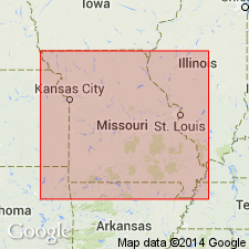
Pg. 421. Galesburg shale of Kansas City group. Thickness about 8 feet in Madison County, Iowa. Separates Swope formation below from Dennis formation above. Age is Late Pennsylvanian (Missourian).
Source: US geologic names lexicon (USGS Bull. 1200, p. 1454).
For more information, please contact Nancy Stamm, Geologic Names Committee Secretary.
Asterisk (*) indicates published by U.S. Geological Survey authors.
"No current usage" (†) implies that a name has been abandoned or has fallen into disuse. Former usage and, if known, replacement name given in parentheses ( ).
Slash (/) indicates name conflicts with nomenclatural guidelines (CSN, 1933; ACSN, 1961, 1970; NACSN, 1983, 2005, 2021). May be explained within brackets ([ ]).