

- Usage in publication:
-
- Frenchman Springs Basalt Member
- Modifications:
-
- Original reference
- Dominant lithology:
-
- Basalt
- Diatomite
- AAPG geologic province:
-
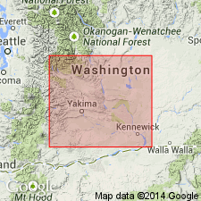
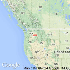
- Eastern Columbia basin
Summary:
Pg. 5, 8 (fig. 2), 12-21, 39-40. Frenchman Springs Basalt Member of Yakima Basalt. Contains distinctive phenocrysts, mostly plagioclase (weakly zoned, partly resorbed). Includes (ascending), all new: Ginkgo flow, about 150 feet thick; Sand Hollow flow, about 100 feet thick; Sentinel Gap flow, about 125 feet thick; and Squaw Creek diatomite, lateral equivalent of Sentinel Gap. Total thickness about 300 feet in Vantage-Priest Rapids area, south-central Washington. Overlies Vantage Sandstone Member (new) and underlies Roza Basalt Member (new); both of Yakima Basalt. [Age is late Miocene.]
Named from exposures in Frenchman Springs Coulee [Frenchman Coulee, Evergreen Ridge 7.5-min quadrangle], Grant Co., south-central WA, where two flows (Ginkgo and Sand Hollow) and Squaw Creek are present.
[NOTE: The Department of the Interior's Secretarial Order 3404, issued on November 19, 2021, formally identifies the term “squaw” as derogatory. That Order will create a federal Derogatory Geographic Names Task Force, to find replacement names for geographic features in use by federal agencies. We’re awaiting guidance from the Task Force, and will then take the appropriate actions.]
Source: Publication; US geologic names lexicon (USGS Bull. 1350, p. 274); GNU records (USGS DDS-6; Menlo GNULEX).
- Usage in publication:
-
- Frenchman Springs Member*
- Modifications:
-
- Areal extent
- Redefined
- Adopted
- Dominant lithology:
-
- Basalt
- Diatomite
- AAPG geologic province:
-
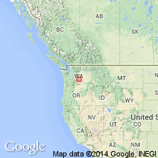
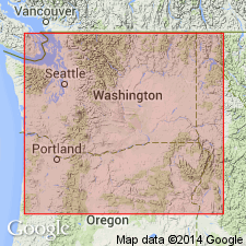
- Columbia basin
Summary:
Pg. C87-C90. Frenchman Springs Member of Yakima Basalt of Columbia River Group. Name modified to Frenchman Springs Member (adopted by the USGS). Geographically extended into Whitman and eastern Franklin Counties, southeastern Washington; sections in Yakawawa Canyon southwest of Pullman, [in SW/4 sec. 26 and NW/4 sec. 35, T. 13 N., R. 44 E., Pullman quadrangle (scale 1:125,000), Whitman Co.], and in Devils Canyon near Kahlotus, [in NW/4 sec. 9, T. 13 N., R. 34 E., Kahlotus 7.5-min quadrangle, Franklin Co.]. Is chiefly dark-gray to black, fine- to medium-grained, sparsely porphyritic basalt with unevenly distributed partly resorbed yellowish-white phenocrysts. Consists of six flows in Devils Canyon where it is about 265 feet thick and three flows in Yakawawa Canyon where it is about 230 feet thick. Not subdivided in this area. Includes Squaw Creek Diatomite Bed of Mackin (1961), or its equivalent in places. Underlies Roza Member of Yakima Basalt. Age is late Miocene or early Pliocene.
[NOTE: The Department of the Interior's Secretarial Order 3404, issued on November 19, 2021, formally identifies the term “squaw” as derogatory. That Order will create a federal Derogatory Geographic Names Task Force, to find replacement names for geographic features in use by federal agencies. We’re awaiting guidance from the Task Force, and will then take the appropriate actions.]
Source: Publication; US geologic names lexicon (USGS Bull. 1350, p. 274); Changes in stratigraphic nomenclature, 1966 (USGS Bull. 1254-A, p. A6); GNU records (USGS DDS-6; Menlo GNULEX).
- Usage in publication:
-
- Frenchman Springs member*
- Modifications:
-
- Revised
- Age modified
- Dominant lithology:
-
- Basalt
- AAPG geologic province:
-
- Eastern Columbia basin
Summary:
Pg. G3 (fig. 1), G6-G8. Frenchman Springs Member of Yakima Basalt of Columbia River Group. Contains two to six basalt flows. Of these, the three flows comprising the member in Vantage-Sentinel Gap area were named from nearby localities. Lowermost flow, Gingko, was named from Gingko Petrified Forest, the Sand Hollow was named for a tributary valley on east of Columbia River nearly opposite Vantage, and Sentinel Gap was named for water gap through Saddle Mountains. The three flows and additional unnamed flows exposed east of Connell make up member within central Washington. Total thickness as much as 375 feet. Includes Squaw Creek Diatomite Bed at top. Overlies Vantage Sandstone Member and underlies Roza Member; both of Yakima Basalt. Age is late Miocene, based on stratigraphic relations of Yakima Basalt. (Frenchman Springs Member of Yakima Basalt of Columbia River Group adopted by the USGS.)
[NOTE: The Department of the Interior's Secretarial Order 3404, issued on November 19, 2021, formally identifies the term “squaw” as derogatory. That Order will create a federal Derogatory Geographic Names Task Force, to find replacement names for geographic features in use by federal agencies. We’re awaiting guidance from the Task Force, and will then take the appropriate actions.]
Source: US geologic names lexicon (USGS Bull. 1350, p. 274); Changes in stratigraphic nomenclature, 1966 (USGS Bull. 1254-A, p. A9); GNU records (USGS DDS-6; Menlo GNULEX).
- Usage in publication:
-
- Frenchman Springs Member*
- Modifications:
-
- Revised
- Reference
- AAPG geologic province:
-
- Eastern Columbia basin
Summary:
Pgs. G2 (fig. 1), G4 (table 1), G6 (fig. 2), G10-11 (table 2), G22, G31-G33, pl. 1. Frenchman Springs Member of Wanapum Basalt of Yakima basalt subgroup [informal] of Columbia River Basalt Group. Most extensive member of the Wanapum. Commonly consists of 3 to 6 flows. At type locality consists of 2 informal flows (the Gingko and Sand Hollow of Mackin, 1961); thickness 75 m. Most flows have scattered glomerophyric clots of plagioclase, a cm or more in diameter. Large phenocrysts of olivine are notable in a few flows, but sparse in most. All flows have normal magnetic polarity, and all are characterized by the Frenchman Springs chemical type of Wright and others (1973). In most places, the Frenchman Springs overlies Grande Ronde Basalt (new); contact is generally well-defined by saprolite or arkosic to subarkosic siltstone and sandstone at top of Grande Ronde. In eastern part of Columbia Plateau, where saprolite or interbed is absent and Frenchman Springs flows are aphyric and indistinguishable from underlying Grande Ronde, contact is placed at the "titanium oxide discontinuity" of Siems and others (1974). In parts of southeast Washington, and northeast Oregon, the Frenchman Springs overlies and is locally interbedded with Eckler Mountain Member (new), basal member of Wanapum. Underlies Squaw Creek Member [See note at end of this entry] of Ellensburg Formation (revised) at type. Elsewhere, underlies Roza Member of Wanapum. Age is middle Miocene, based on stratigraphic position. Type clarified and several reference localities given. Report includes stratigraphic charts, map of localities, map showing inferred original distribution, table of major-element composition of chemical types.
Type locality of Mackin (1961) clarified (see fig. 1, loc. 72 and pl. 1, fig. E, this report): in Frenchman Springs Coulee [Frenchman Coulee], in secs. 19, 20, and 21, and secs. 29 and 30, T. 18 N., R. 23 E., [Evergreen Ridge 7.5-min quadrangle], Grant Co., south-central WA.
Reference localities (see fig. 1, locs. 45, 47, 62, 74, 88, 109): (1) in roadcuts and natural exposures in Devils Canyon, south of Kahlotus, in the Kahlotus and Lower Monumental Dam quadrangles, WA; (2) on both sides of Wallula Gap, WA (Atlantic Richfield Hanford Company, 1976, v. 2, p. B24-B26); (3) on the Maryhill grade along Highway 97 north of Biggs, OR (Hammond and others, 1977); (4) along the Deschutes River just north of Maupin, OR (R.D. Bentley, unpub. map, 1977); (5) roadcuts and railroad cuts in Palouse Falls State Park, WA (Swanson and Wright, 1976); and (6) at Rattlesnake Spring in Moses Coulee, WA (Siems and others, 1974).
[Yakima basalt subgroup considered informal and should not be capitalized. "Subgroup" not recognized as a formal stratigraphic rank term (CSN, 1933; ACSN, 1961, 1970; NACSN, 1983, 2005, 2021). Columbia River Basalt Group adopted by the ID, OR, and WA Geol. Surveys, and the USGS.]
Atlantic Richfield Hanford Company, 1976, Prelim. Feasibility study of storage of radioactive wastes in Columbia River basalts, ERDA Rept. ARH-ST-137, v. 1, text, 168 p., v.2, App. 264 p.
Hammond, P.E., and others, 1977, IN Brown, E.H., and Ellis, R.C., eds., Geol. excursions in Pacific Northwest, Western Washington Univ. Press, p. 127-169.
Siems, B.A., and others, 1974, GSA Bull., v. 85, p. 1061-1068.
Wright, T.L., and others, 1973, GSA Bull., v. 84, p. 371-386.
[GNC remark (March 2023): to be in conformance with the Dept. Interior Secretarial Order 3404, the USGS, in cooperation with the Washington Geological Survey, is in the process of formally renaming this unit.]
Source: Publication; GNU records (USGS DDS-6; Menlo GNULEX); Changes in stratigraphic nomenclature, 1979 (USGS Bull. 1502-A, p. A17, A24, A65, A73, A82, A85).
For more information, please contact Nancy Stamm, Geologic Names Committee Secretary.
Asterisk (*) indicates published by U.S. Geological Survey authors.
"No current usage" (†) implies that a name has been abandoned or has fallen into disuse. Former usage and, if known, replacement name given in parentheses ( ).
Slash (/) indicates name conflicts with nomenclatural guidelines (CSN, 1933; ACSN, 1961, 1970; NACSN, 1983, 2005, 2021). May be explained within brackets ([ ]).