

- Usage in publication:
-
- French Valley Granodiorite*
- Modifications:
-
- Named
- Geochronologic dating
- Dominant lithology:
-
- Granodiorite
- AAPG geologic province:
-
- Okanogan province
Summary:
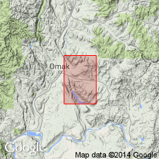
Named for exposures in vicinity of French Valley, Omak Lake area. Type locality designated as exposures in roadcuts along Route 10A east of Omak about 0.3 mi west of where Route 10A crosses Haley Creek, SE/4 sec.7 T33N R28E, Omak Lake 15' quad, Okanogan Co, WA. Crops out also in Disautel 15' quad. Is one of two formally named units in mylonitic orthogneiss that crops out in broad belt northeast of Omak Lake, Mission Creek and French Valley Granodiorites. French Valley consists of equigranular biotite granodiorite; ranges in composition from granodiorite to tonalite. K-feldspar megacrysts present near contact with Mission Creek Granodiorite. Has U-Pb age of about 55 Ma (D. Parkinson, USGS, unpub. data). Provisionally assigned Cretaceous or Eocene age.
Source: GNU records (USGS DDS-6; Menlo GNULEX).
For more information, please contact Nancy Stamm, Geologic Names Committee Secretary.
Asterisk (*) indicates published by U.S. Geological Survey authors.
"No current usage" (†) implies that a name has been abandoned or has fallen into disuse. Former usage and, if known, replacement name given in parentheses ( ).
Slash (/) indicates name conflicts with nomenclatural guidelines (CSN, 1933; ACSN, 1961, 1970; NACSN, 1983, 2005, 2021). May be explained within brackets ([ ]).